Kayak Camping – Hawkesbury River


Berowra Creek, viewed from Twin Beaches (South Beach)

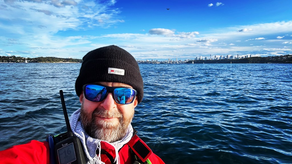
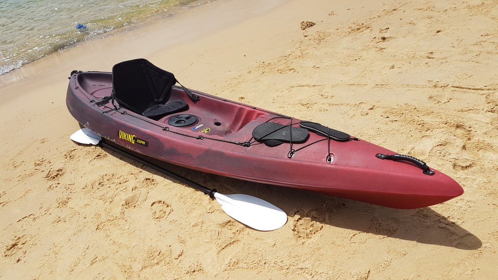
It’s been just over a year since I packed up the tent and other camping gear in the kayak and went ‘walkabout’ – a one night stay at Gentleman’s Halt campground, in the vicinity of Spencer on the Hawkesbury River (and a blog for another day!). Although these last 12 months have seen plenty of paddling and several camping trips, there’s been nothing combining the two. So, before the fierce heat of summer fully arrives, I decided it was time to make use of a few days off mid-week and get back out there.

Stretching and meandering some 120km, the Hawkesbury River runs from its origin somewhere north of Penrith, easterly, to where it empties into the Central Coast’s Broken Bay. I’ve spent the last few years exploring almost every nook and cranny the Hawkesbury has to offer – up to Wiseman’s Ferry (a 55km paddle from Broken Bay), the wide expanses of Brisbane Water and Pittwater, and the lengthy Cowan and Mooney Mooney Creeks.

Having tracked pretty much all of the shorelines these waterways have to offer, I find myself repeatedly drawn to Berowra Creek. Being that bit further up the Hawkesbury and more inland than, say Cowan Creek, it feels a little less exposed to coastal elements (swell, stronger winds) – and although maybe not too much less trafficked, the buzzing jetskis that plague the Broken Bay area are certainly a pleasant rarity.

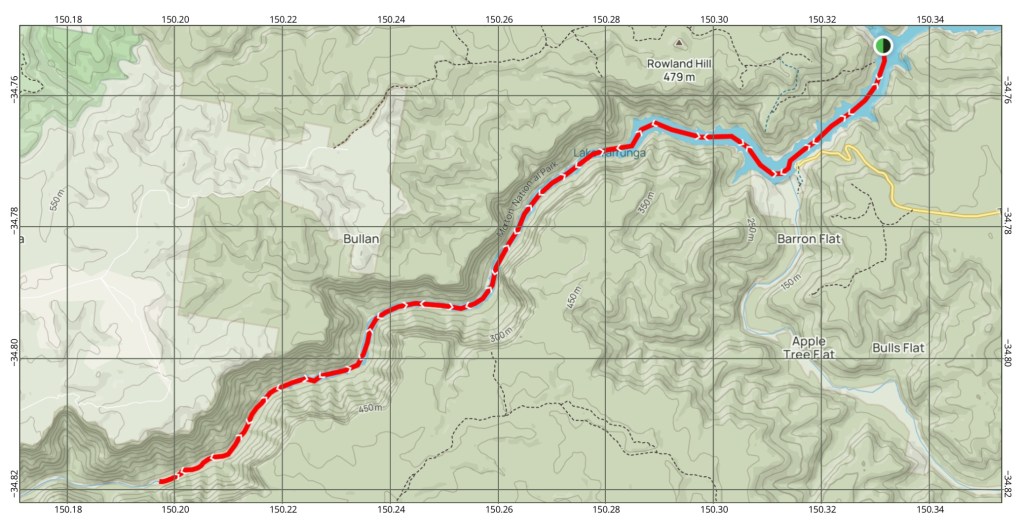
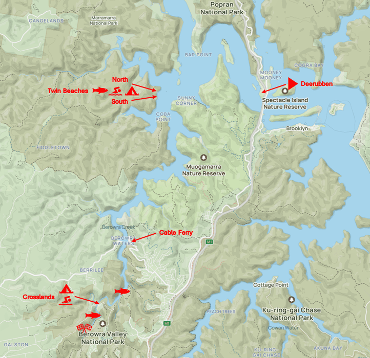
I’ve lost count of the number of trips I’ve made around the ‘top end’ of Berowra Creek, launching at Deerubbun boat ramp (Hawkesbury Interchange on the M1 Pacific Motorway), then down around Bar Island and Coba Point. I’ve paddled to Berowra Waters a few times, also, but I’ve only made it to the very end of Berowara Creek just once (as its a fair distance and you need higher tides at the end).

On each trip, though, one of the Twin Beaches has always been a guaranteed stop-over, for lunch and often a swim. Both have a long-drop toilet, too, so if you don’t like digging holes, then these are definitely the beaches for you!


The plan then:

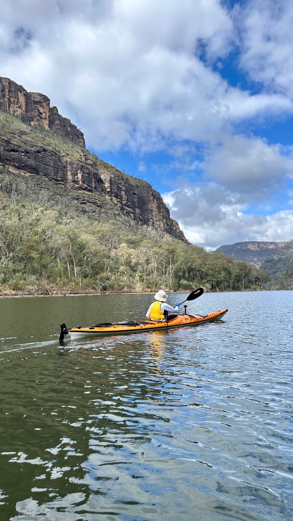
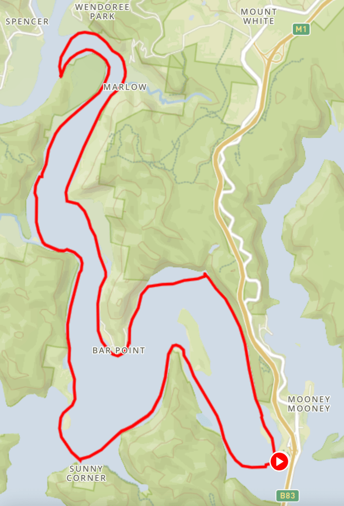
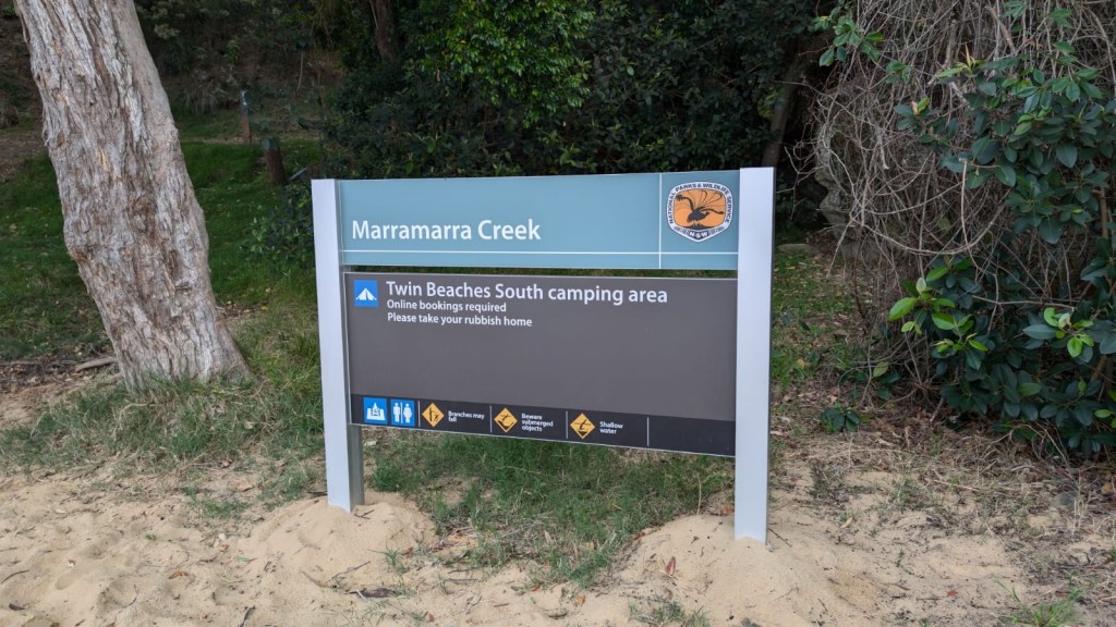
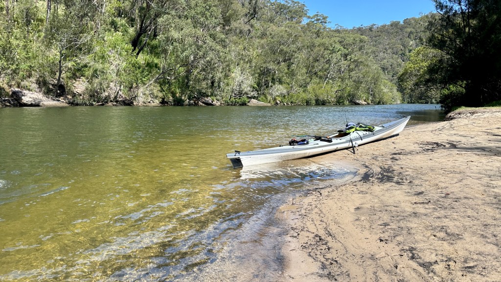
  • Day 1: launch at Deerubbun with the morning tide (route via HMAS Parramatta and Bar Point), paddle 10km to Twin Beaches South, set up camp, scout the lower reaches of the adjacent Marramarra Creek, then have an easy evening by the campfire;
  • Day 2: early launch with the morning tide, then a 30-something kilometer round-trip south, to the very end of Berowra Creek, stopping off at Berowra Waters for coffee on the way down, and at Crosslands campground for lunch on the way back up – swimming/fishing at any convenient location in-between; and
  • Day 3: pack-up camp first-thing, and paddle a slack tide back to Deerubbun (via Sunny Corner and Milson’s Passage).

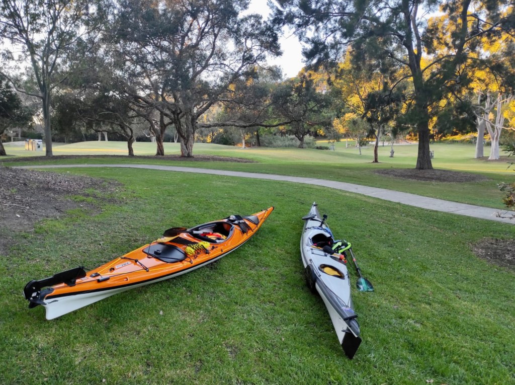
It was a great plan! However, we arrived at Deerubbun a little later than planned, and with a spring tide, we found we had little or no beach to load-up the kayaks on, and it was a bit frustrating trying to stuff everything into the kayaks whilst they were being buffeted by the waves created by the occasional passing boat.

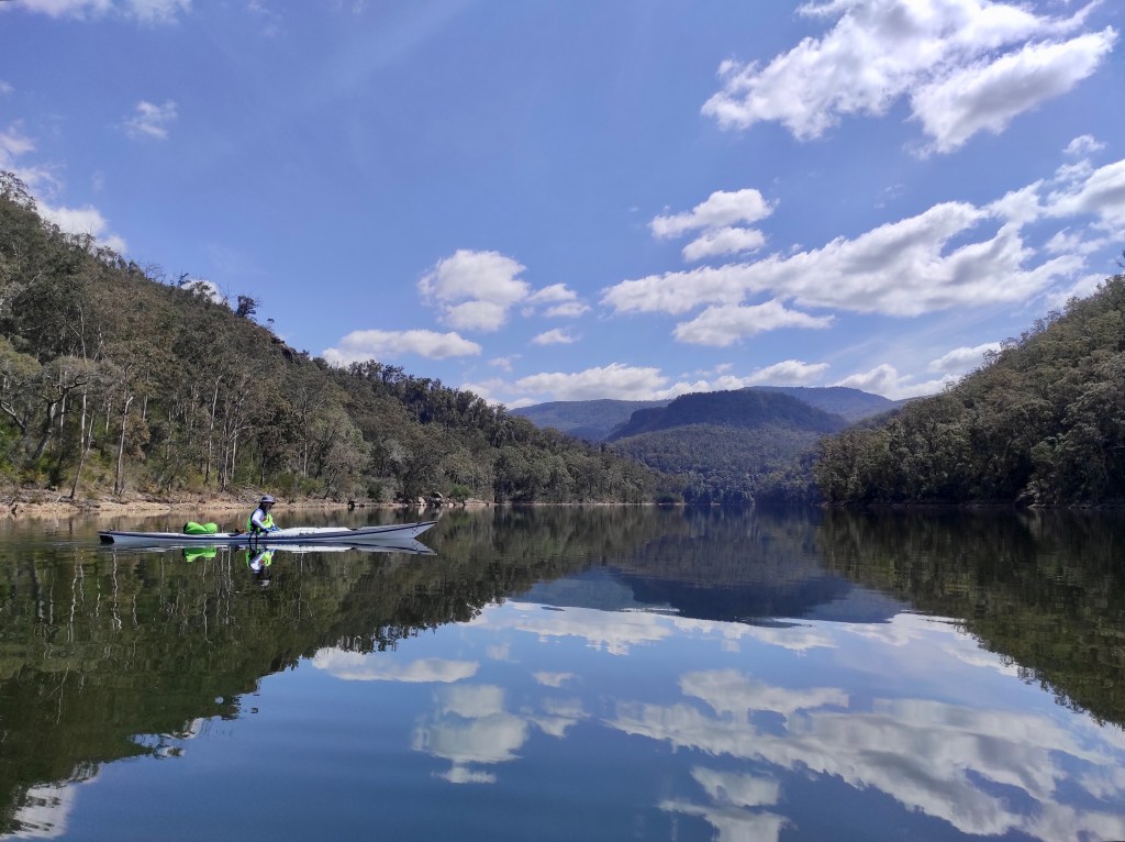
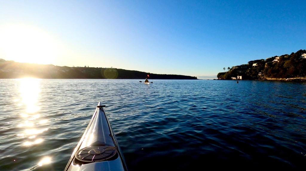
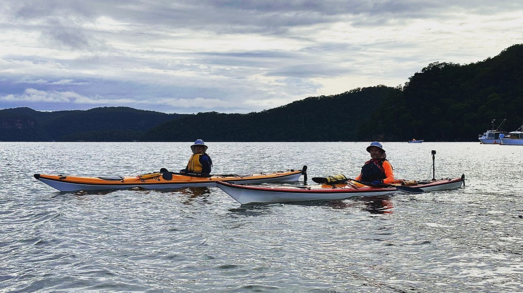
Catching the remainder of the rising tide, though, the paddle around the northern shoreline – taking in the sights of HMAS Parramatta – was straightforward and relaxing, and we arrived at our (deserted) destination in a little under two hours.

HMAS Parramatta, best seen at lower tides – but watch out for mud flats and the old oyster leases!
Arriving at (a deserted) Twin Beaches South, our home for the next three days
It might be cloudy, but these were great conditions for kayaking – and we could expect the sun to be shining the next day!

Looking North, to Bar Island

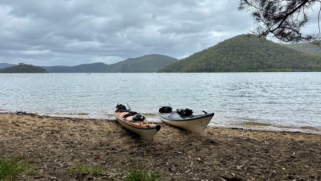
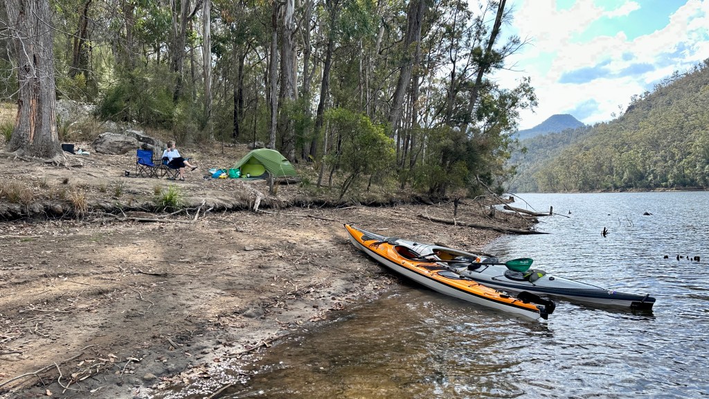
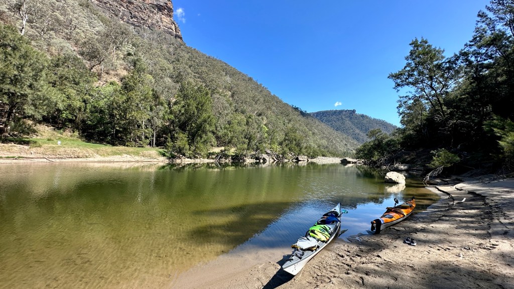
The south beach is more spacious – and in my view more scenic and enjoyable – than the north beach, but still it only has four bookable camping spots. Whilst each site can be booked for up to four people, the sites themselves are not particularly separated, or spacious. That said, camping is free, you just pay the NSW Parks & Wildlife $6 booking fee – and I’m fine paying this small sum to access such great facilities.

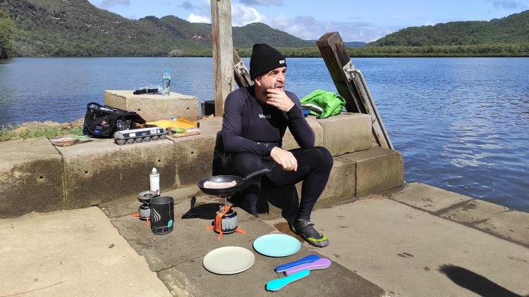
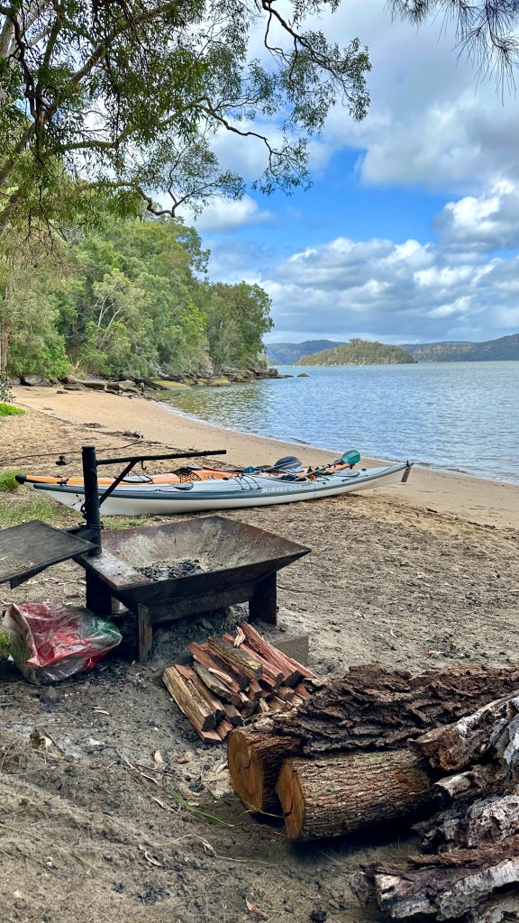
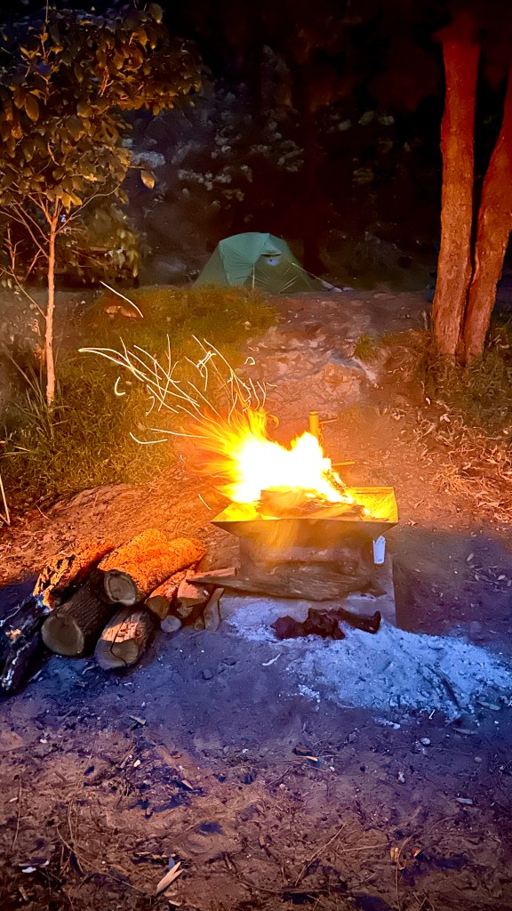
Each camping spot has it’s own firepit, which we used both nights (incl. the first night to cook on), but I recommend taking your own firewood with you as we found much of what might otherwise be available was likely scavenged by previous campsite visitors.

A little concerned for the high tides occurring in the area over the last few days, we selected the beachfront fire pit but pitched our tent up from the beach, claiming the one picnic table as part of our base of operations.

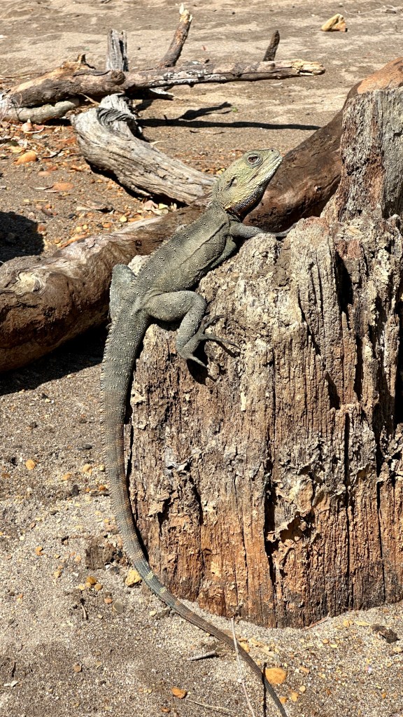
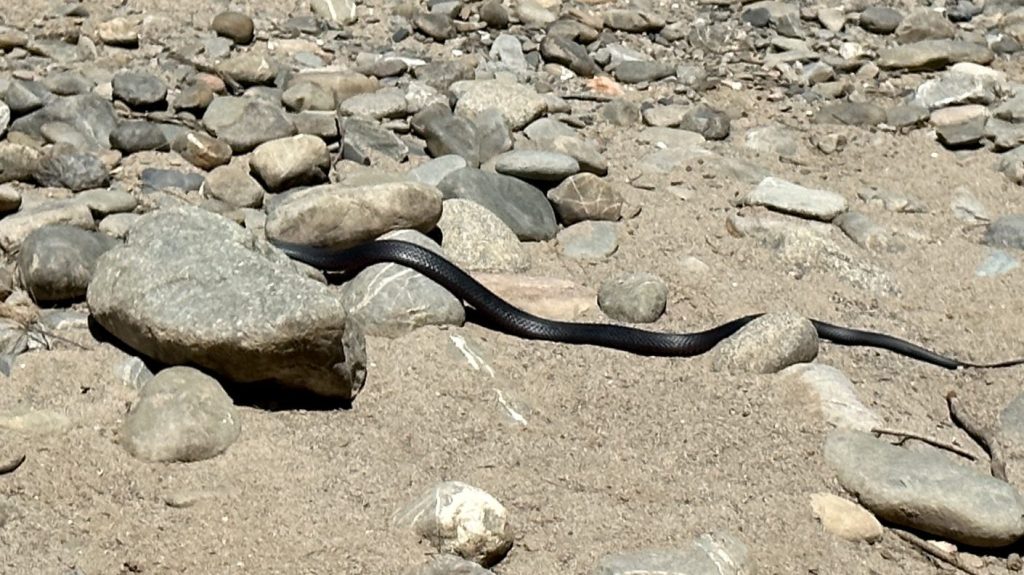
The flies and mosquitos were surprisingly absent on the first night – no doubt encouraged by our blazing campfire to go and bug (literally!) someone else – but were back on the second night. This was to be expected though, so as always, bring the appropriate insect repellent and first aid kit items (Stingoze etc.). I did manage to step on a bull ant (or something similar) and suffered a fairly painful bite, so, as I was reminded, respect nature – and keep your shoes on!

It’s not camping without a campfire!

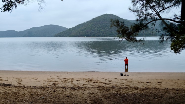
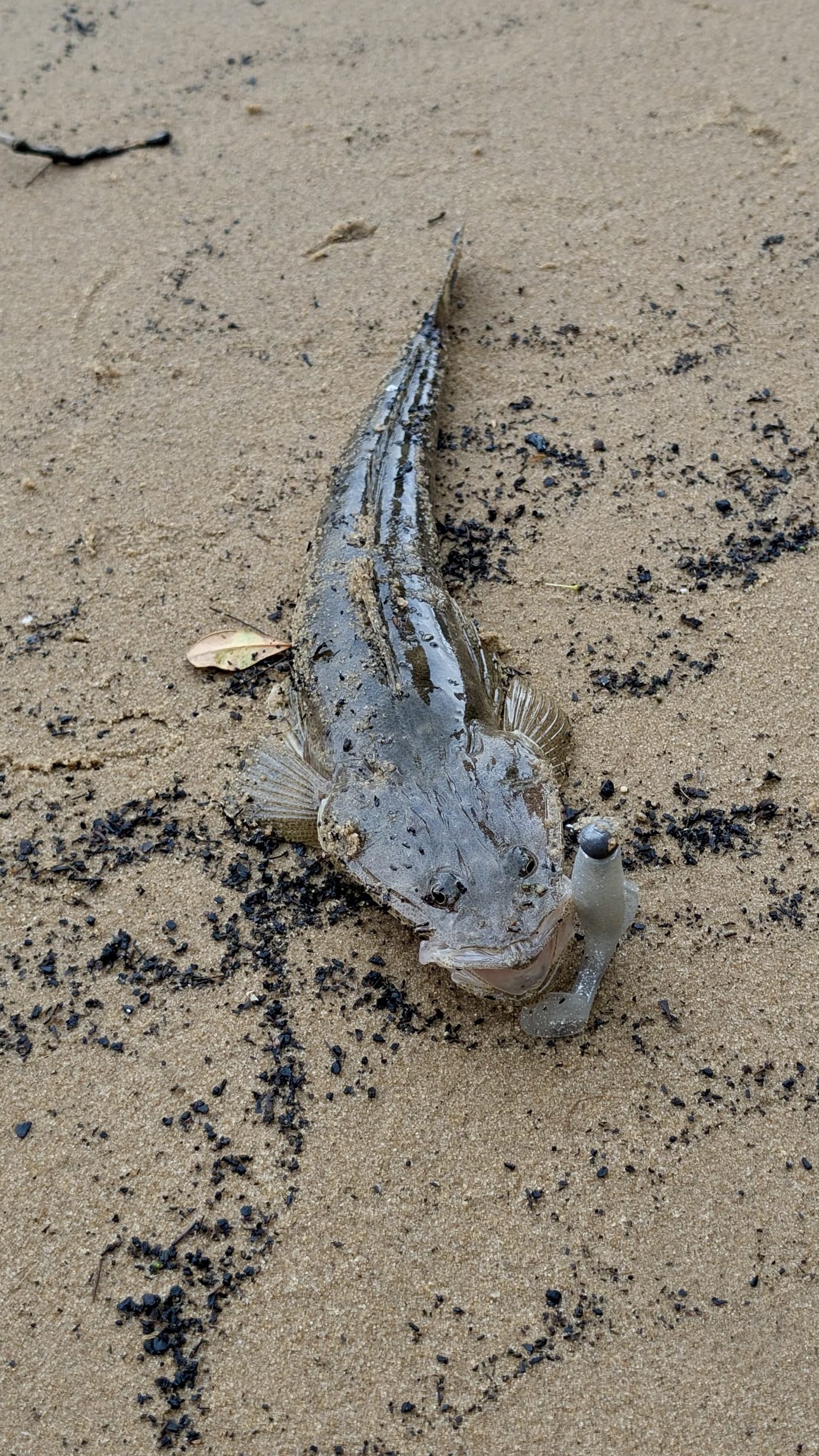
Although I’ve yet to realise my aspiration of catching dinner whilst kayak-camping, my fishing efforts with a ‘softie’ lure that afternoon were rewarded with a small dusky flathead – but nothing else for the whole trip, despite the fish constantly jumping, and there being shoals of large bream among other species all the way to the end of Berowra Creek. A paddler I may be, a successful fisherman I am most definitely not!

The flathead were biting, but I didn’t catch enough for dinner
This little one was set free

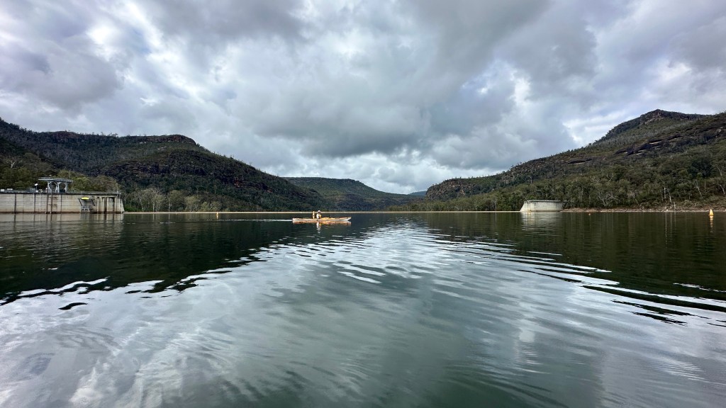
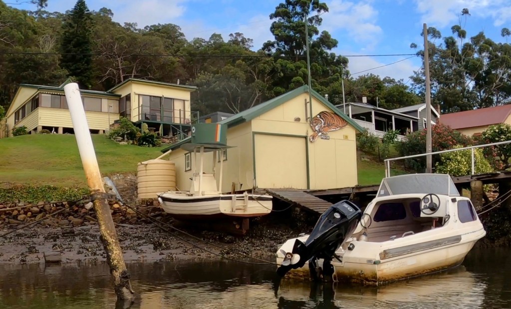
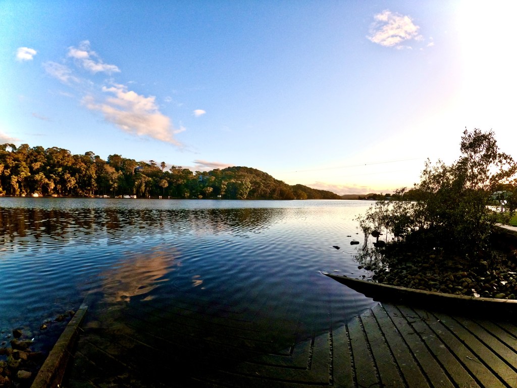
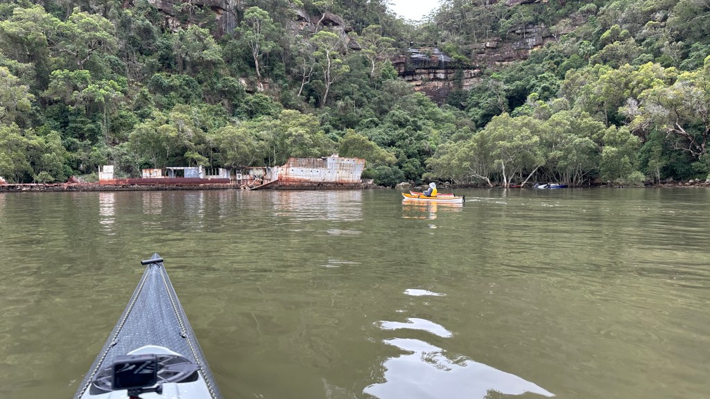
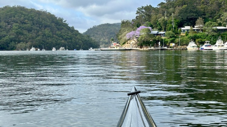
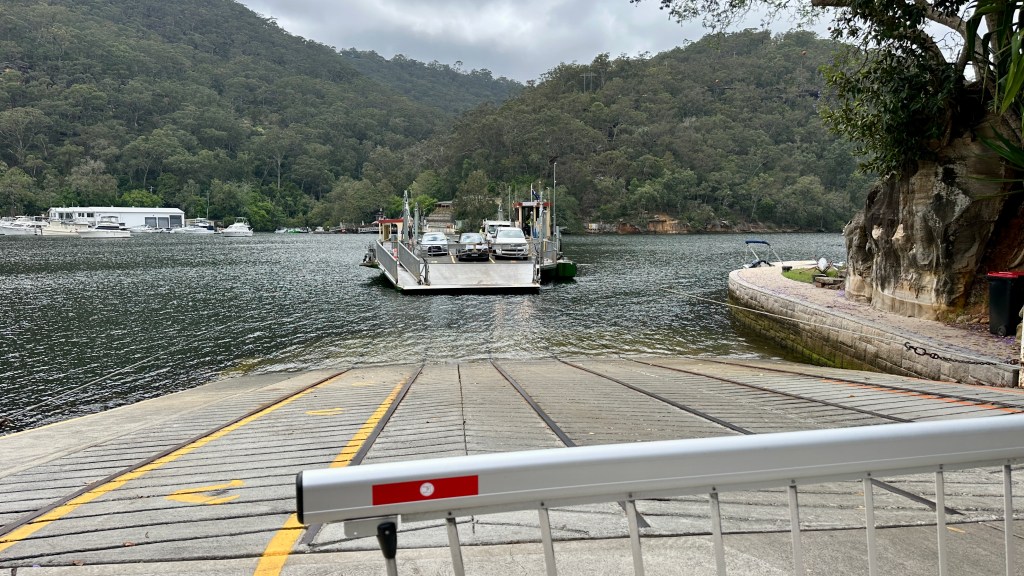
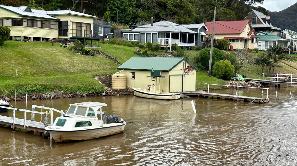
A place worth visiting in its own right – and certainly as part of any paddle on Berowra Creek, is Berowra Waters. Charaterised by its classic Hawkesbury River-style cable ferry, this very small town is best seen from the water. Paddle the shorelines and have a good nosey at the fancy riverside dwellings, before cautiously paddling over the ferry’s pair of cable lines draping across the waterway.

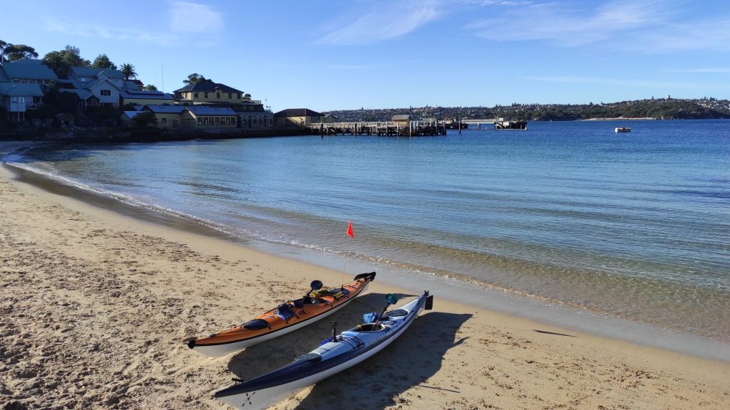
We opted to stop at the public boat ramp and marina, on the western shoreline, where I knew there to be a cafe/restaurant where we could enjoy ourselves a coffee and a pastry before continuing down the creek. We also used the opportunity to stretch our legs, have a short stroll and watch the ferry operations for a little while.

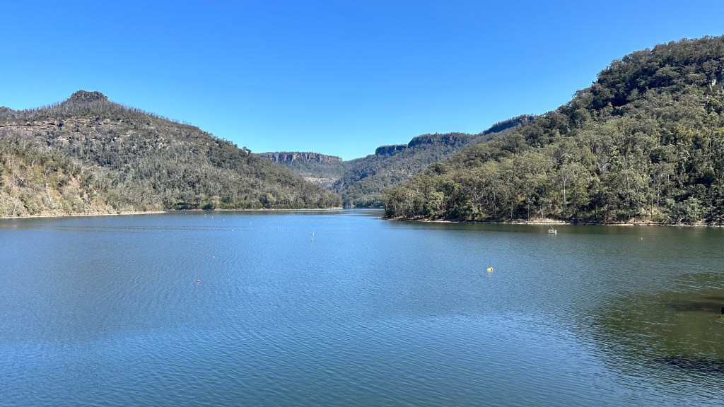
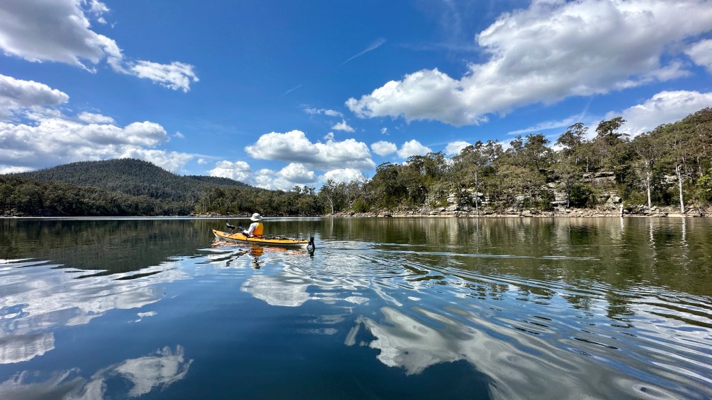
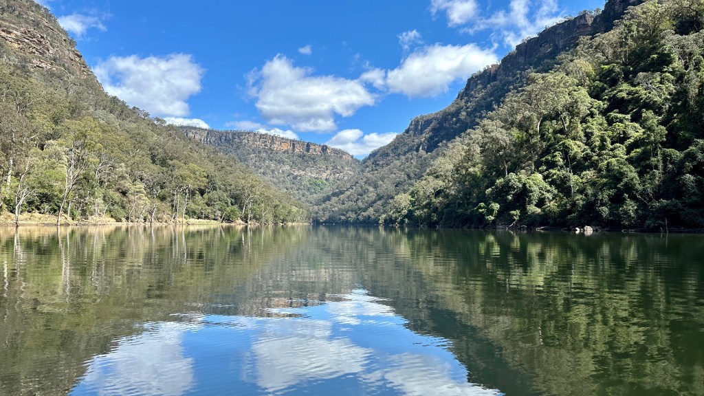
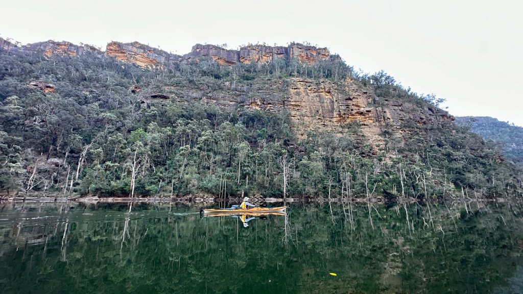
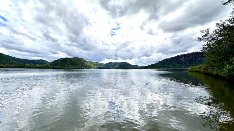
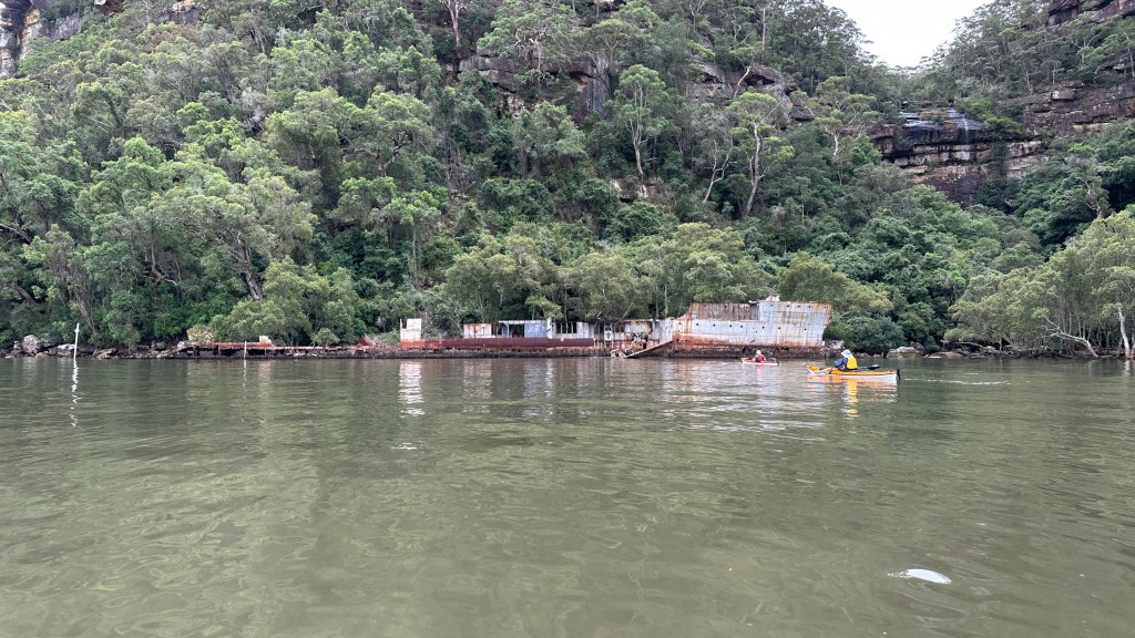
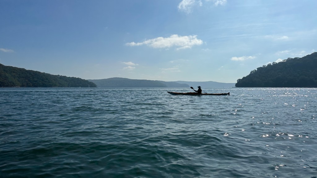
Further downstream, the channel first widens and gets very shallow (requiring a rising/hide tide to navigate it) before then narrowing again and becoming much more navigable. The upside of this is that there are almost no motor craft to be found once you leave Berowra Waters, making for a much more serene and peaceful paddling experience.

Downstream of Berowra Waters

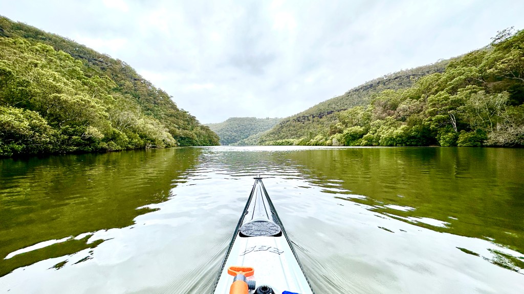
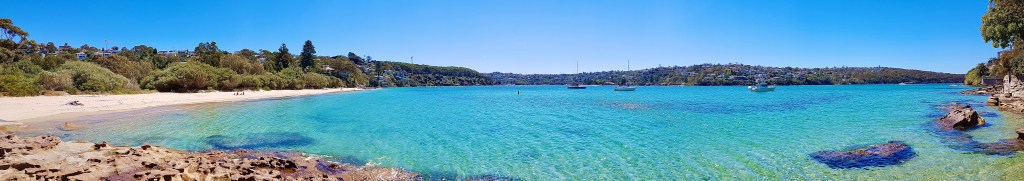
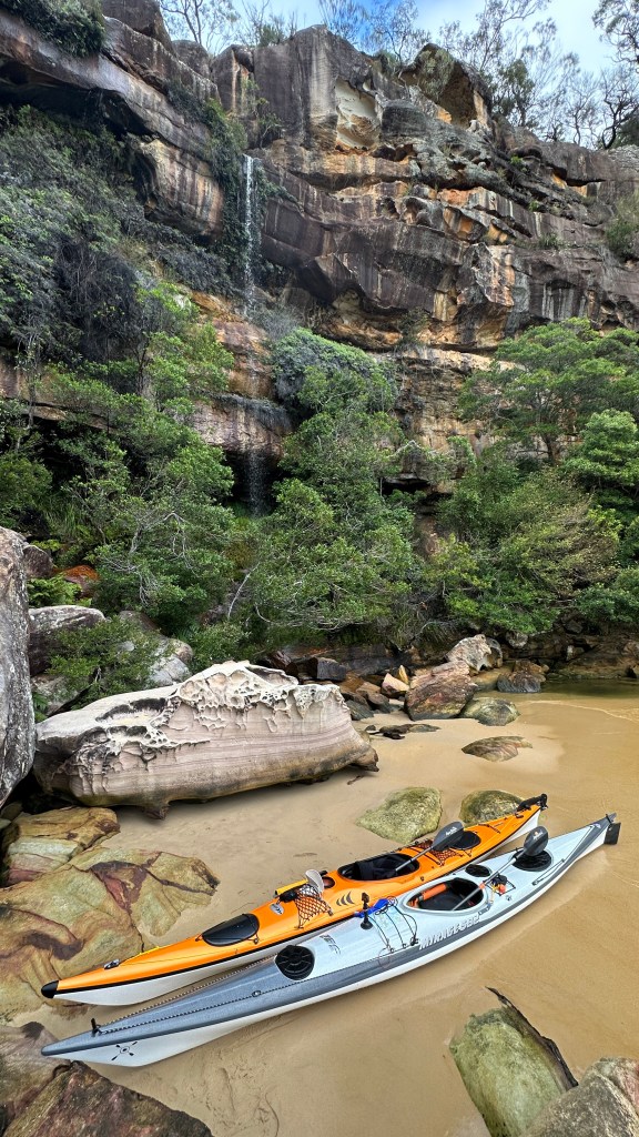
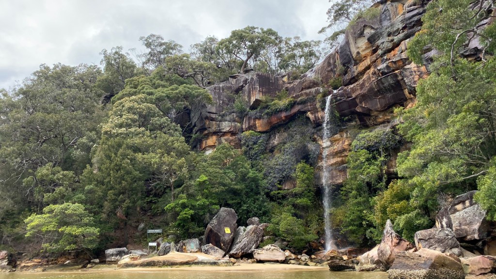
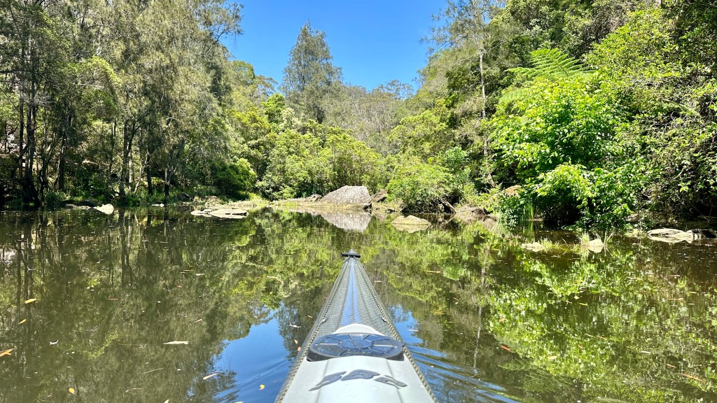
Just a few easy kilometers past Berowra Waters we arrived at our destination, the end of the navigable section of the creek, the waterway made impassable by a tumble of large boulders. What does stand out here the most, though, is the transformation in vegetation – lush green rainforest taking over from the predominantly bush and gums of the higher reaches of the creek, teeming with many different types of birds, such as the Eastern Whip bird, making its distinctive call.

End of the line – Berowra Creek continues, but it’s not navigable by kayak

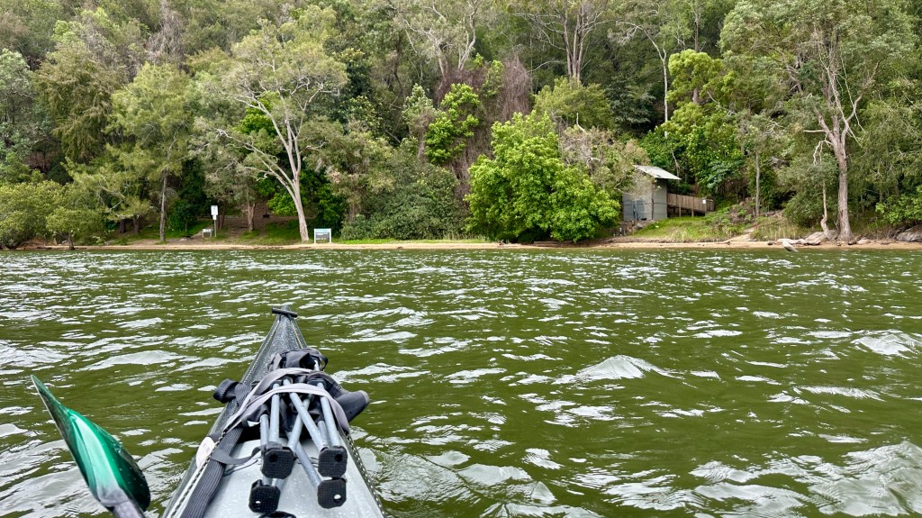
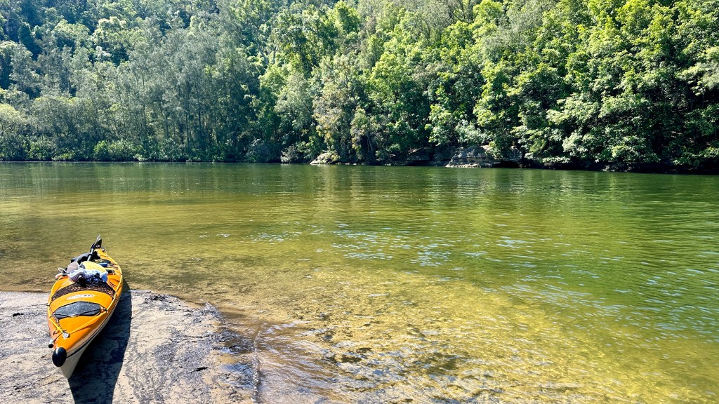
By midday, the clouds had cleared and the sun was really starting to warm things up, so on the way back up we decided to stop off at the northern end of Crosslands campground where we’d earlier spied a sandy beach perfect for landing the kayaks on, and clear, flowing water, ideal for a refreshing dip.

The northern end of Crosslands campground – time for a swim
Freshwater feeds into the Creek making the water less salty

All-told, the we covered about 35km and were out for about 10 hours. That said, we’d caught the rising tides out, and the falling tide back, plus had received some assistance from the wind in several sections – so despite us having a long day out on the water, we weren’t completely exhausted.


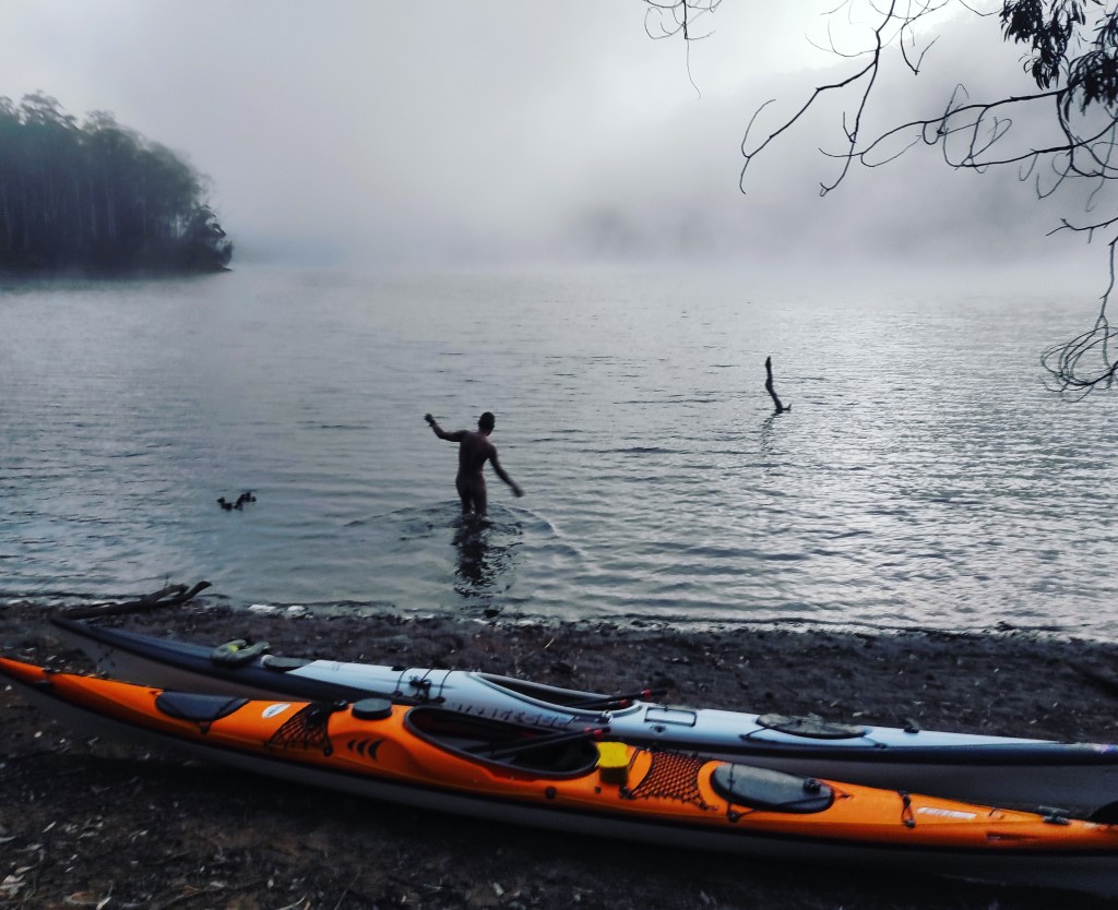
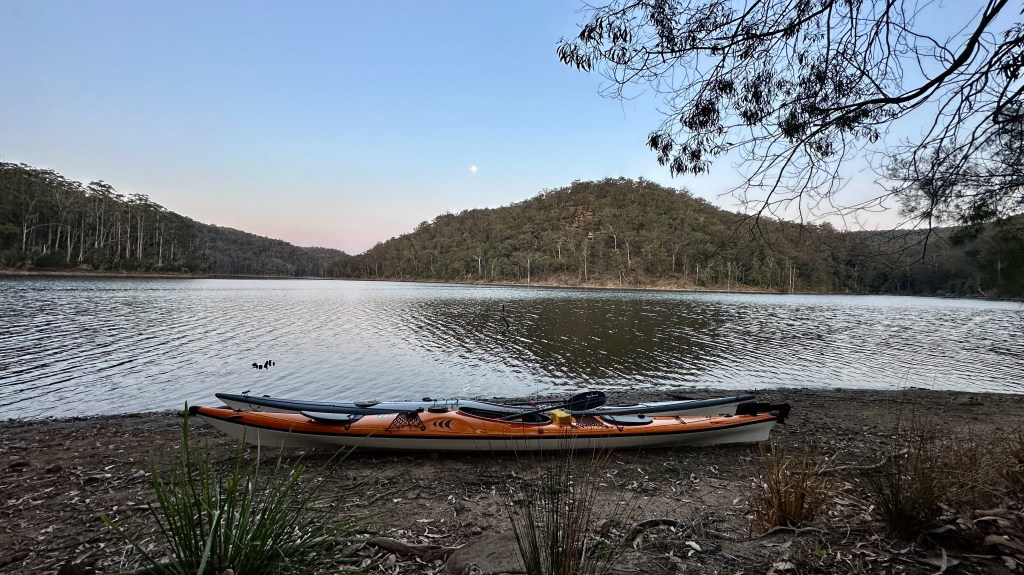
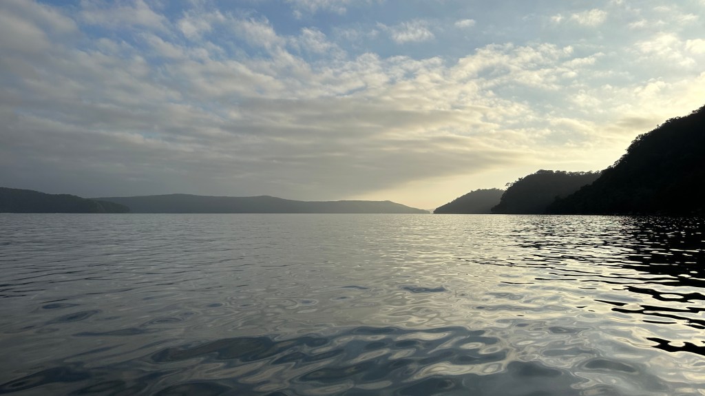
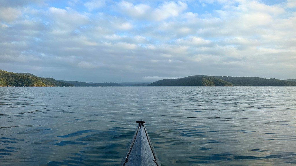
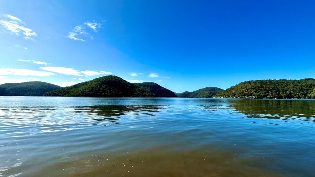
Or maybe we were – I never find that I have my best night’s sleep when camping, but I certainly slept well that night (after another wine-accompanied campfire), and rising in the morning for that all-important first cup of coffee of the day was not at all difficult. But maybe that was more to do with the sunrise that welcomed us…

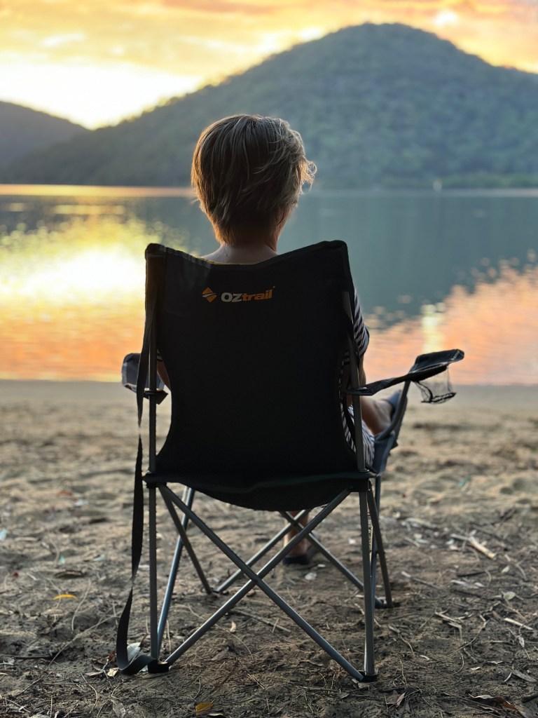
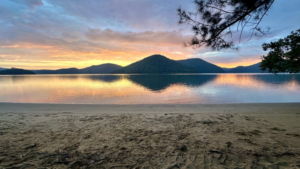
After enjoying the tranquil views that lay before us, enjoying these calm, still and peaceful waters, we reflected on how fortunate we were to have had such an amazing playground more-or-less to ourselves.

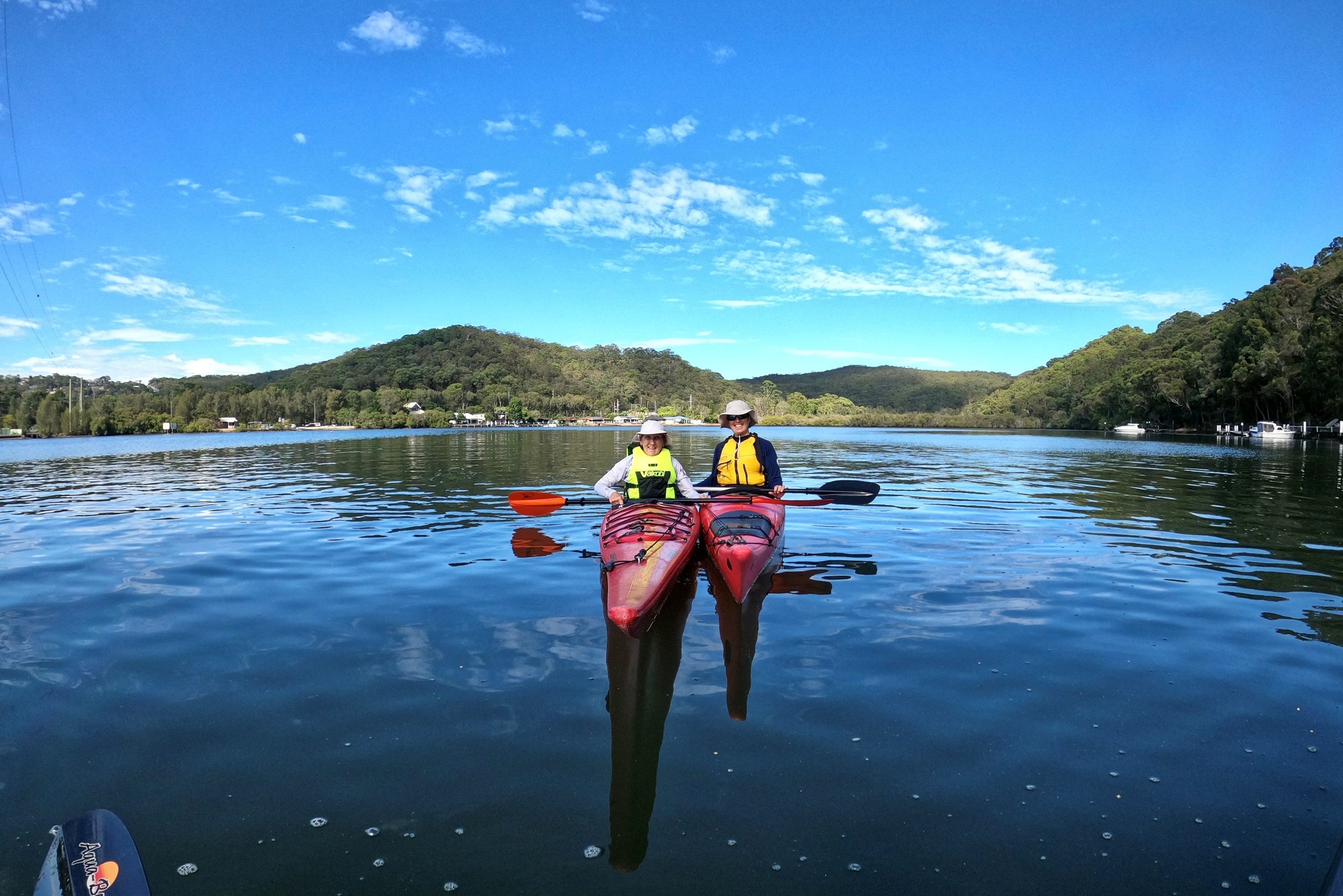
Coffee cups emptied we decided to break camp, load up the kayaks and catch the tide for an easy run back to Deerubbun. Our return leg would see us follow the opposite side of the Hawkesbury to that on our outbound leg, skirting the shores of Muogamarra Nature Reserve and paddling through the little hamlet of Milson’s Passage.

Milsons Passage

It was definitely a trip worth doing, and one I shouldn’t have waited so long to do. This amazing waterway, and this fantastic campsite are right on the doorstep, so I’m glad we finally made this outing happen.

And I strongly encourage you all to do the same!

Kayak Camping – Shoalhaven and Kangaroo Rivers

Kangaroo River (East of Tallowa Dam)

Just four months ago, the NSW Central Coast was where I kayaked, and camping was most definitely not my thing. Fast forward to a couple of weeks ago, and I’ve camped three times – twice by kayak – and I’ve been north, paddling on the NSW Mid-North Coast, and south, to the state’s Southern Highlands.

Located two hours south of Sydney, is the massive Morton National Park, the traditional country of the Yuin people. And nestled in the centre of this – not too far from the regional towns of Bowral, and Mittagong – is the 1970s constructed Tallowa Dam, marking the confluence of the Shoalhaven and Kangaroo Rivers and creating Lake Yarrunga.

Lake Yarrunga (looking west/upstream along Shoalhaven River)

From the lake above the dam, the Shoalhaven River to the west is flatwater with negligible flow and navigable for approx. 15km. Likewise, the Kangaroo River to the east, which is navigable a little further, approx. 21km. Downstream of Tallowa Dam, the Shoalhaven river is fast flowing, running south, then through Nowra and finally out to sea at Shoalhaven Heads into Shoalhaven Bight.


Planning the trip was more tricky than I’d expected, as although there are numerous campsites on this river system, working my way around the NSW Parks & Wildlife website’s booking and information pages was more challenging that it should be.

In short, all of the campsites operate on a first come-first served basis. However, so that numbers can be managed, you are required to make a booking for staying at any of the national park campsites on Lake Yarrunga: Shoalhaven River (to the west), and a separate booking for staying at any of the campsites on Lake Yarrunga: Kangaroo River (to the east). Bookings are free, but there is a $6 booking charge. I had made a booking on both river sections although, ultimately, we only stayed on the Kangaroo River section – and fortunately for us, we found every campsite we encountered to be completely vacant, despite us staying during a school holiday period.

Another source of confusion was the naming of the campsites, with signposts on the ground not always matching the naming on the NSW Parks & Wildlife website. For example, the interactive map on the website (and also Google Maps) shows the ominously named ‘Fly Land’ campsite as being the first campsite on the Shoalhaven River, upstream from Tallowa Dam. Yet, on the downloadable .PDF map, and at the campsite itself, this campsite is named ‘Tom’s Gully’ – which makes sense given that the little creek that runs down the hills at that point is also labelled as ‘Tom’s Gully’. And the same applies to ‘Tallowa Dam’ campsite, named on the ground as ‘Sawyers’. You are also minded to check the website for campsite closures, where some campsites may be closed due to fire damage or flood debris.


Effortless paddling on the Kangaroo River

After a three hour drive down from the NSW Central Coast, stopping-off in Bowral for a quick coffee and delicious lemon muffin (from Primary Espresso), we arrived at Tallowa Dam at about 9.30am. We unloaded the kayaks and all our camping gear at the top of the boat ramp in the Tallowa Dam picnic area, then left the car in the car park of the well-facilitated picnic area. An hour later, we were enjoying effortless paddling on the Kangaroo River – albeit somewhat more heavily laden than usual – heading for our chosen campsite.

Heading east, we paddled leisurely up the Kangaroo River, keeping an eye out for any-and-all campsites, passing first ‘Sundeck’ then ‘Sawyers’, both sign-posted as ‘Closed’, paddling about 7km upstream to the junction with Yarrunga Creek where ‘Beehive Point’ and ‘Tigersnake’ campsites are located. Beehive Point campsite is accessible by road and so we were not minded to pitch up at what we thought might be a less peaceful site. Jumping out of the boat to inspect ‘Tigersnake’, not otherwise visible from the water (common to several campsites!), I encountered yet another ‘Closed’ sign – but also a gang of NSW Parks & Wildlife workers felling and clearing fire-damaged trees. They advised that, provided we’d made campsite bookings, we were good to stay at any of the campsites – so back to Sawyers we headed!

Sawyers (aka ‘Tallowa Dam’) campsite, home for the next two nights

‘Sawyers’, like several of the campsites along both stretches of river, is equipped with a long drop toilet – but not much else! Some areas of hard (and I mean hard!) packed earth marked where tents could be pitched, and a ring of stones and some burned logs indicated where previous tenants had enjoyed the all-essential camp fire, but that was it as far as amenities went. And we were perfectly happy with that! Facing east we could enjoy the sunrise, had our own personal strip of sandy beach providing a soft landing for the kayaks – and a place to swim and bathe in the freshwater of the river. We also had, so far at least, the park to ourselves for at least a 2km radius!

We’re still evolving our approach to kayak-camping, by which I mean we’re still working out what we don’t need to bring! Both kayaks were pretty heavily laden, although this wasn’t helped by us bringing two 10L canisters of drinking water. The car was parked just a few kilometres away so we were able on this trip to leave some of our provisions there, knowing we would pass by there twice the next day. Still, it’s a work-in-progress while we progressively weed-out non-essential equipment from our equipment lists.


Early afternoon, and after pitching the tent and enjoying our first camp meal, we headed out to explore Broughton Creek which extends north from Sawyers for about 7km. This gave us our first experience of the flooding caused by the damming of the valley 40 years earlier, with the remains of massive gum trees poking their skeletal tips skyward through the river’s mirror-like surface – but creating a multitude of sub-surface kayak hazards!

Gum tree ghosts – a common sight on all of the waterways upstream of Tallowa Dam

Returning to the campsite late afternoon, with the last of spring’s evening light, it was really easy to gently paddle the kayaks up onto the sandy strip at the base of our beachfront real-estate.

Fresh water kayaking – paddle, swim, wash, drink

Dinner, not-a-campfire-as-there-was-a-solid-fuel-fire-ban, and a fair night’s sleep, saw us up early the next morning. With first-light brightening the tent, I was up and straight into the water for a morning dip before breakfast. Used to the salt water of the NSW Central Coast, having water I can paddle on, swim in, wash in and drink was a refreshing change in every sense!

Washed and clean, full-up on a camp breakfast of porridge, honey and berries, the main event of this trip lay immediately ahead – paddling the full length of the Shoalhaven River upstream of the dam, and through the Shoalhaven Gorge.

Our Shoalhaven Gorge route – Sawyers campsite to Fossickers Flat (approx. 35km return)

Our 7.30am start was met with mild and cloudy conditions, threatening to spoil the photos and GoPro videos we were planning to take that day, but with no rain and only a light breeze forecast, we weren’t complaining.

We paddled the 2km back downstream along the Kangaroo River from our Sawyers campsite, and then cut across the back of Tallowa Dam along the yellow warning marks, using the opportunity to fully take-in this construction.

Tallowa Dam

From what we’d seen of the Kangaroo River, it looked to be a fairly open river environment and paddling experience, but already on the Shoalhaven River we were getting a feel for the steep sided gorges that we’d soon be encountering – map contours indicating gorge sides in excess of 250 metres and high points of 400 metres!

And, thankfully, the skies were clearing too, with the sun increasingly brightening the water to a beautiful deep green and lighting up the sandstone and rocky landscape seemingly reaching out of the river skywards and pushing the clouds away for us.

Following the river upstream and enjoying the perfectly calm, flat and almost current-less waters, the banks slowly begin to close-in, and the waterway becomes more winding, adding to the sense of mystery created by this Jurassic-looking landscape.


The campsites listed on the NSW Parks & Wildlife map are tricky to spot, a couple of which we only spotted on the return leg when their signs were more visible from the opposite direction. Each of the campsites we came across had only several areas suitable for pitching tents, and my concern at camping along these two waterways in busier, summer months, would be having to keep moving-on from one campsite to the next until finding a vacant lot. That said, there are many, many perfect spots along the spectacularly scenic shores of both the Shoalhaven and Kangaroo rivers where one could easily set up camp – provided you didn’t mind risking the possible wrath of a parks ranger!

Spectacular scenery at every turn

One thing about this stretch of water that made us glad we’d selected a campsite on the Kangaroo River, was the prevalence of some of nature’s ‘wilder’ wildlife. Whilst the many, many water dragons we encountered – either sunning themselves on rocks and fallen trees stretching out into the water, or swimming like Olympic athletes – were a delight to observe, less welcome were their reptilian cousins in the serpentine family. I was most happy that the red-bellied black snake we saw slithering along the shoreline preferred the warm and rocky shore of the Shoalhaven River, rather than the sandy strip of beach by our tent on the Kangaroo River.

Eastern waterdragon
Red-bellied black snake

Fossickers Flat marks the end of the kayak-navigable stretch of the Shoalhaven River. A series of shallow rapids prevents any further upstream progress, but an amazing ‘lagoon’ is formed at this point. With the sun now blazing down from directly above, this was a perfect time and the perfect location to enjoy lunch, a swim – and take in the absolute peace, quiet and solitude of this remote and totally unique location.

The beautiful ‘lagoon’ at Fossickers Flat

Ordinarily, I find the return-leg of a paddle to be much less interesting than the out-bound leg – a combination of ‘seen this already!’, and ‘are we back at the car yet?’. Not so on this trip though! Everything seemed to be as though we were seeing it for the first time, with the changing position of the sun in the now clear skies, illuminating the sheer rock faces with that special, Australian warm-sun glow – the intense colours of earth, water, bush and sky all complementing each other.

The setting sun creates yet a different feel in the gorge

The entire three day/two night trip was centred around paddling this stretch of water – and each-and-every one of the 30km or so we had paddled were worth it. We still had one night of camping to enjoy, but as we completed the final stretch of the day, passing back past the dam, we were immensely satisfied with the experience of the day.

All day we’d seen just a couple of other paddlers, and to all intents and purposes we’d had the whole gorge completely to ourselves. I think we could plan fifty repeat trips and not encounter such ’emptiness’ – we’d been very fortunate and we knew it. However, we still had the length of the Kangaroo River to explore, so we would definitely be back, probably sooner rather than later.

The next morning we’d be breaking camp early and hitting the road home, but in that moment, in that place, we knew we had truly experienced the feeling that only kayaking brings; a sensory mix of the sights, sounds and smells of beautiful waterway, staggering scenery and an inner peace that the tranquility of remote Australian countryside brings.

Moonrise at the end of an amazing day on the water

If you’ve never camped, kayaked – or kayak-camped – before, there’s no better place to start. And if you have, well, make sure the Shoalhaven and Kangaroo rivers feature on your kayaking bucket-list!

Sydney Harbour

So, not the NSW Central Coast, I know, but tell me – who wouldn’t want to paddle their kayak past the iconic Sydney Opera House and under the world famous Sydney Harbour Bridge?


Oh Boy! Sydney Harbour – what a place to take your Kayak

It’s been over two years (and four months and three weeks – but who’s counting?!) since I’d last paddled Sydney Harbour, and back then I was still exploring the waters of NSW on sit-on-tops. I was keen to get back, this time in a sea kayak, and keen to share the experience with a new kayaking partner – so last Sunday, that’s what I did!

We may be up on the NSW Central Coast, but kayak put-in points on Sydney Harbour are little over an hour’s drive and so are easily within reach for a day’s paddling – just make sure to double-up in the car to save on fuel and parking, and aim to arrive early enough to ensure you can park close to the water.

Rosherville Reserve in Sydney’s Mosman suburb – enough parking, provided you arrive early

Chinamans Beach, accessed via Rosherville Reserve in Sydney’s Mosman suburb, is a fantastic place to start any trip out on Sydney Harbour. Centrally located close to Middle Head, you’re in easy reach of everything the big end of the Parramatta River has to offer.

The reserve itself is huge – and you could be forgiven for forgetting you were nestled in one of the most expensive suburbs in one of the most well known cities in the world. The adjacent Chinamans Beach has fine and golden sand, and waters that are beautifully calm, amazingly clear and a breath-taking green/blue in colour.

Looking back across Chinamans Beach and Rosherville Reserve (2021)

With the start of winter just a few days away, the air was crisp and fresh, but the rising Australian sun soon began to cast its warmth so, on the basis that the forecast wind would fight a losing battle with the clear sunny skies, it was off with the jackets!

Launching from Chinamans Beach at sunrise – with a sneaky peak out through the Sydney Heads

Leaving Chinamans Beach and following the shoreline around, the route took us past Balmoral Beach which, even at 7.30am, was bustling with all manner of people making the most of a beautiful Sunday morning: kayakers and sea-swimmers were out in large numbers, whilst on the shore, joggers, runners, people fishing and families taking a leisurely stroll were everywhere! The place was alive!


Passing Balmoral, and then the naval base at HMAS Penguin, we rounded Middle Head and got our first proper views of the harbour heading up towards the city proper, with the Eastern Suburbs in the distance and closer, Vaucluse, Watsons Bay, Shark Island – and the Manly Ferry!

Mindful of the swell reverberating off the rocky shore at the base of the cliffs on this section of coastline, we continued on to our first stop at Chowder Bay where a delightful little ‘hole in the wall’ cafe served us up hot coffee and a fine salmon bagel and muffin.

Clifton Gardens at Chowder Bay – first stop of the day and time for a coffee

And whilst we enjoyed this fine breakfast back on the beach, we got talking to the owners of three amazing, handmade wooden sea kayaks. Beautiful to look at, we were amazed at how such things could be made by hand, yet achieve the necessary water-dynamics for tracking, balance and manoeuvrability. These local kayakers also shared with us their views on the weather that threatened to come on later – and on the basis of which we decided to amend our plans from having an open channel crossing between the harbour’s Heads on the way home. Not wishing to be out in the open with moderate to fresh breezes, we re-planned to instead take a shorter and more protected route back on our final leg.


Leaving Chowder Bay we next headed along the shoreline for Bradley’s Head and past that, the famous Taronga Zoo – where we had our first of the day (and definitely not last) close encounter with one of the Harbour Ferries. Here, also, we were afforded our first view of that classic and unmistakable city sky line – the Westfield Eye, Opera House and Harbour Bridge all seemingly beckoning for us to come much, much closer.

The unmistakable sky line of this amazing harbour city slips into view

At about this time the clouds had started to roll in, and the forecast wind started to step up to its commitment to making our day a whole lot more challenging. The harbour is open and exposed to the wind and the 16kt westerly coming straight at us from under the Harbour Bridge itself used the long ‘fetch’ to create some small whitecaps that combined with the wash of many large boats to give us a bumpy ride in to our mid-point destination.

Passing through the Sydney Harbour Bridge Transit Zone we were mindful not to ‘…exceed 15kts, anchor or drift.’! The predictable chop and swell created by the many boats and vertical harbour walls kept our minds sharply focused on a safe transit!

Some hefty – and technically challenging – chop and swell required our utmost concentration

Blues Point had been the destination for lunch, but on closer inspection of this headland we determined that there were no places suitable for a safe landing, and heading instead to nearby Lavender Bay we were rewarded with the perfect strip of beach to land on, the perfect piece of grassy area to stretch out for lunch on – and a fantastic view of one of our national treasures.

Lunch with a view – Lavender Bay is prime real estate

Refreshed with lunch – a highlight of my day – we headed back out under the Harbour Bridge, retracing our inbound route staying on the Kirribilli (north) side, away from the busy ferry traffic entering and leaving the Circular Quay ferry terminals. Once under the bridge, however, we headed south-east across the busy shipping channel to square-off face-to-face with the Sydney Opera House, so impressive up close and from the water. From the Opera house we tracked across the front of Garden Island naval dock yards, keeping the requisite 60m from the massive Canberra-class landing helicopter dock ship, HMAS Adelaide (L01), the largest naval vessel ever built for Australia.

Staying in the open channel from Garden Island, we dodged the many sail boats and yachts that had turned out to make the most of the afternoon winds, following a route to Clarke Island, then Shark Island and then up to Watson’s Bay for our final stop of the afternoon – and another coffee.

35km – Middle Head to Blues Point (under the Sydney Harbour Bridge), returning via Watsons Bay

Overall, the tracked route matched our planned route (incl. for distance, about 35km), except for the shoreline route around Taronga and Neutral Bay that was in lieu of the planned final run back to the put-in point from South Head – we instead turned for home at Watsons Bay.

That Heads crossing I’d been looking forward to would now have to wait for our next trip on these waters, which I hope we’ll be back to do soon.


You can’t leave Sydney Harbour without taking at least one selfie!

As the afternoon slowly drew to a close, the cloud had cleared, the wind had dropped and the day showed signs of finishing much like it had started – cool, clean and peaceful – accentuating the beauty of this fine harbour’s scenery.

Sydney is just a fantastic place to visit, no matter your mode of transport. But viewing its amazing harbour from the unique vantage point afforded by a sea kayak – and sharing that experience with someone – well, that’s next level in my book!

The Australis Gecko – small sea kayak, big sea fun


The first kayak I owned was a Viking Espri sit-on-top kayak (SoT). I paddled this very capable 3.6m, super-stable SoT for three years, taking it out on many different water types, from the calm Narara Creek, to the open seas between Terrigal Haven and Ettalong; and on progressively longer and longer trips until I maxed-out the range possible in daylight hours. It was soon time to switch-up to something more suitable that combined distance with speed and storage/load-carrying capacity.

In May 2021, some time between the various COVID-19 lockdowns and other restrictions that were in force around that time, I managed to acquire a 5.2m Necky Elaho HV sea kayak – my first experience with a ‘sit-in’ kayak. I found that I could cruise this thing faster than at my top speed on the Espri, and my range was near-doubled. It had two main storage hatches and a ‘day hatch’ just behind the cockpit, and I could carry a whole range of equipment and safety gear with me. And all of a sudden my day-trip expeditions became a whole lot more fun.

The transition from SoT to ‘sit-in’ was not a smooth one for me. At 28kg, the Necky was not a light boat, particularly when loaded with a day’s gear. And, more challenging for me as a newcomer to ‘sit-ins’, it had a soft, ‘multi-chine’ hull (i.e. quite ‘V’ shaped in profile) which meant that whilst it had excellent secondary stability, it’s primary stability I found to be pretty poor – it was constantly ‘tippy’ and I never felt really comfortable paddling it.

That all changed in June 2022 when I swapped-out the Necky for a new Kevlar Mirage 582. At 18kg (unloaded, and minus the electric bilge pump) this was a much lighter craft, and as the hull design is so much better in every respect, I no longer feel like I’m riding an angry steer that wants to buck me off all the time!

For many reasons, though, the Mirage isn’t ideal for delivering flatwater instruction in – not least because it’s both at the higher end of the kayak price range, and instruction and training sessions can include a fair bit of rough and tumble, particularly when the course location doesn’t have a soft sandy shoreline to launch from.

Given I’ve started to spend a lot more time in the education space, I felt that I needed something which I could ‘bang around’ a bit more if needed – and something a little smaller and easier to manhandle, and more manoeuvrable.

Enter stage-right the Australis Gecko, the smallest in the Australis Lizard Sea Kayak Range.

The Australis Gecko sea kayak

Features

Visually, the Gecko has I think a really nice form – well proportioned, with smooth curves and lines; sleek, yet functional and practical. It comes in five striking colour schemes: the fluoro-green (which I opted for, pictured), dark blue/white, orange/yellow, red/yellow and yellow. Each of these bright colour schemes is off-set with a colour-coordinated set of Gecko decals.

No mistaking this model – a Gecko!
Easily adjustable foot-pegs

At 20kg and 4.4m in length, this is a pretty light and easy to manhandle kayak, and I find it really easy to lift unassisted onto my car’s roof bars, and from a storage perspective, poses less of a challenge that my longer Mirage.

  • Length: 4.4m
  • Width: 62cm
  • Depth: 34cm
  • Cockpit: 50 x 86cm
    NB: Sea to Summit Flexi-Fit neoprene spraydeck size ‘L’ fits perfectly (not the ‘M’ per Sea to Summit sizing charts!)
  • Weight: 20kg
  • Hatches (sealed by rubber covers): Front – 18cm round, Rear – 41 x 23cm oval
  • Dry Storage: Front – 50 litres, Rear – 85 litres.
  • Capacity: 140kg (depending on water conditions)
  • Decklines front and rear
  • Bungee on forward cockpit coaming
  • Carry toggles

With bungees across the front deck, I’m able to place essentials like a laminated route map, plus emergency equipment like a paddle float and bilge pump, keeping these items secure yet ready to hand should I need them. There is also a small amount of storage immediately behind the seat back – where I know some paddlers like to keep their paddle float, already partially inflated.

At 62cm wide (compared to my Mirage, at 55.5cm) the Gecko has a wide, spacious cockpit that is easy to get into, even for larger people. For example, I’m 5’10” and 90kg, and with the kayak floating in the water, I can easily straddle it with my legs, drop my bottom into the seat and tuck-in my legs.

The readily adjustable footpegs which ‘click’ into place on their runners accommodate both taller and shorter people alike, and combined with the thigh braces, allow you to comfortably ‘wedge’ yourself into the seat so your lower body is secured and ‘one’ with the kayak. This arrangement also enables you to generate a good amount of ‘leg drive’ and so put power into each paddle stroke.

Spacious cockpit with plenty of leg-room

The rudder controls are toe-operated ‘flaps’ atop each of the two footpegs, and the rudder cables are easily adjusted even whilst sat inside the kayak. It takes just a matter of minutes to correctly set-up the rudder, and ‘full’ rudder movement can easily be achieved. The rudder itself is lowered and raised into the water with a pulley system that runs along the right side of the kayak, with very accessible controls located at the right hip.


Handling

The outstanding feature of this sea kayak, in my view, is it’s high degree of primary stability, whilst still being able to ride on an edge (secondary stability). Last week I took it out into the surf at a couple of local beaches and it was an immense amount of fun – and I didn’t get rolled once. Combining a tight turn with a solid ‘low brace’ meant I could easily keep the kayak level when turning in a breaking wave, or at the shore after a nice run-in.

Being a shorter kayak, I found it easier to keep a straight track when riding a wave, whereas with my longer (5.5m-5.8m) sea kayaks I find them to be more prone to being turned. And the shorter length also provided more manoeuvrability when on the wave, especially when combined with use of the built-in rudder and application of some ‘stern rudder’ strokes.

Riding rolling waves is heaps of fun!
Turning in a breaking wave? No problem!

Being shorter – with what I consider a fair amount of ‘rocker’ – means, however, that operation without the rudder requires a little concentration in delivering smooth, consistent strokes on each side, whether moving forwards or in reverse, to maintain a straight track. I confess to being a little on the lazy side and so always use a rudder when one is available.

But this is what creates that manoeuvrability which makes turning this kayak so very easy, perfect for when exploring those narrowing creeks, or when up close to the shoreline and you need to wind your way through rocks and other obstacles. A handful of combination forward-reverse sweeps will see you spin the Gecko 180° (or 360°!) with the greatest of ease!

Plenty of ‘rocker’ helps make this sea kayak highly manoeuvrable

In summary…

I love the Mirage 582, and it’s absolutely my kayak of choice for longer, touring trips. But from the simple perspective of getting out on the water quickly and care-free, this tough, plastic kayak is my preference. I can bang it around if I need to and drag it up onto beaches (or even complete beach/surf landings) without fear of damage that’s costly and time-consuming to repair.

The Australis Gecko is fully-featured, but everything is simple and easy to operate, and where you need it to be. It’s undoubtedly a fantastic boat for people new to sea kayaks (or ‘sit-ins’), yet a great performer for the more advanced paddler. And although there’s no such thing as an all-rounder kayak, the Gecko will see you right whether it be on flatwater environments, or out in the swell, waves, chop and surf of enclosed and open seas. I can’t recommend this kayak highly enough!

And, finally – it’s Australian-made.


How Wet Can It (Really) Get?


Wet is the answer! Very wet!

In the time it took to confirm to the participants that “Yes, the course is still on”, then leave home and arrive at the venue, the weather took a most unfavourable turn. The end of daylight saving time should have made things a bit lighter at this time of day, but the heavy clouds made it seem a whole lot darker.

Yesterday had been very wet, and the forecast had more than teased that today would just bring showers; so of course, today’s session would be going ahead. Yet half an hour later found all of us huddled together stood next to the boat ramp, debating the pros cons and cons of going out on the water. But as the rain dripped off the brims of our coat hoods and hats we made the unanimous decision to ‘do it!’.

The eager participants were here to learn, and learn they would, happy to ignore the big blue splodge on the weather map just to the east of Riley’s Island, marking out a rain-drenched Woy Woy Bay.

The weather RADAR did not look like that the evening before!

Personally, I quite like kayaking in the rain; it often seems to quiet the wind, and in addition to the sound of rain drops pattering on the water’s surface, I love the absence of the sounds normally produced by other water users, allowing us to enjoy a different kind of peace and quite, devoid of outboard engines and whining jet-skis.

The key to a comfortable paddle in the rain is to get into the kayak warm and dry – a good waterproof jacket and wide-brimmed hat are ‘must haves’ – quickly affix the spraydeck, and then you’re good to go. Also, make sure to adjust the drip rings on the paddle shaft so that you don’t get water droplets running down your arms and soaking the inside of your otherwise dry top – water pooling inside your jacket around your elbows is not a pleasant feeling, especially when you then raise your arm, to side draw for example, and it all then runs down your side. (I find positioning the drip rings on the paddle shaft about midway between your hand and the paddle blade works best.)

That said, however, after 30 mins of off-water instruction held under the insubstantial cover provided by some of the reserve’s trees, it was as though we’d just completed our capsize exercise! Keeping warm would be the challenge for the rest of the morning.


Once on the water, and with no wind and only the gentle falling of the tide to cause our craft any movement, we were able to work through the lesson plan at a good pace. And even with two of the participants new to sit-in kayaks, it wasn’t long before we’d completed the first section and were combining those strokes into a ‘task’.

Completing the first task – bringing together forward, emergency stop, and reverse strokes

We next focused on the main turning strokes, the forward sweep and the reverse sweep.

With these strokes it’s essential that in a longer kayak they’re executed effectively to maximise the turn provided through each stroke.

  • Maintain usual paddle grip
  • Hold paddle shaft low across the kayak, centred off to the side of the kayak (to extend reach)
  • Rotate body, keeping the ‘Paddler’s Box’, and make a wide sweeping arc of the paddle from bow to stern (forward sweep) or stern to bow (reverse)
  • Use body to push kayak away from the blade
  • Look, throughout the stroke, to where you want to travel
  • Don’t rush the stroke (to avoid introducing unnecessary forward momentum)

My favourite moment up to this point is where the participants combine a forward sweep with a reverse sweep and find themselves completing a perfect 360° turn virtually on the spot!


To their credit, all of the participants were still up for the ‘managing a capsize’ section of the course – well, we literally couldn’t get an awful lot wetter than we already were!

Working in pairs, each participant rolled their kayak upside down and completed a ‘wet exit’, and after surfacing and becoming the ‘victim’, retrieved their paddle and swam to the front of the kayak. Holding the paddle and kayak in one hand, they used their free hand and legs to ‘swim to shore’ and, after a distance, were relieved by their partner (the ‘rescuer’). The rescuer allowed the victim to hitch a tow by holding onto the rear of their kayak. Again after a distance, the victim then abandoned their kayak and practiced a deck-carry on their rescuer’s kayak for a further distance, or hugged the bow of their rescuer’s kayak, ‘koala fashion’. These moves gave each of the participants an understanding of how to get back to shore where practicable, in a fairly simple manner and without the fuss of assisted- or self-rescues, or setting up rope-based tow-lines.

The next task was for the victim to complete an assisted deep water re-entry. This saw their partner assist them in emptying their kayak of water, ‘righting it’, and then keeping a firm hold of it so that the victim could clamber onto the rear deck, swing their legs around into the cockpit, ‘corkscrew’ their body upright, and then position themselves back inside the kayak.

Today was a great example of when/why it pays not to rush this process, but to think carefully about coordinating the body for each step, and taking a brief pause between each step. It’s tiring manoeuvring your kayak around when you’re in the water, and then tiring also heaving yourself out of the water back onto your kayak. And challenging conditions such as we were experiencing add an extra layer of fatigue, plus the cold can sap your energy reserves even further. In short, you don’t have many attempts at this in you, so it pays to focus, and do this right-first-time.

Finally, with all the participants completing this final exercise in good time, all that remained of the session was to head back to shore and some welcome shelter.

Heading for home!

Days like today create a memory, and it’s a great feeling to know that if you can complete your training and learn new skills in weather like this, then you’re well set for paddling safely in a whole range of conditions. Dry clothes, a Thermos of tea and a heated car were not the only rewards of the day.


Mooney Mooney to Spencer


Looking Upstream From Our Riverside Lunch Spot

Spencer is one of my favourite local areas to paddle, nestled at the wide junction where Mangrove Creek merges with the Hawkesbury River. If launching from Spencer, you have several paddling options: following the Hawkesbury River downstream towards Mooney Mooney and beyond that the sea or off to Berowra Creek, upstream towards the awesome Wiseman’s Ferry, or up Mangrove Creek where you can progress about 15km (if you don’t mind lugging your kayak over a substantial weir).

However, although it’s only 50km away, the 45 mins to an hour’s drive on a sometimes winding and potholed country road to get there somehow always feels a lot longer – so we don’t often go. Today though, we chose to paddle upstream from Mooney Mooney (Deerubbun Reserve boat ramp) to Spencer – a pothole-free run!


Trip plan details

  • Group size – 3
  • Distance – 31 km (actual 32.6km)
  • Duration – 8 hrs (actual 7hr 30min)
  • Weather – cloud/showers, 23°C, moderate breeze (12 kts)

As usual, today’s route was selected to capitalise on favourable tides, on this occasion rising from about 7.30am and achieving fullness at Spencer by about 1pm, with the plan being to arrive at Spencer late morning, cook-up some lunch and then be ready to return on the ebb flow. And avoid any strengthening moderate easterly breezes that would be blowing in our faces on the way home!

The usual MO is to rendezvous at the Coles servo at Kariong at about 6.30am, then travel in convoy (keeping an eye on each others’ kayaks) down to Mooney Mooney (Deerubbun Reserve boat ramp) just off the M1 Pacific Motorway. 25 mins later we were unloading our kayaks and gear onto the small strip of sand adjacent to, and on the western side of, the double boat ramp, and then moving the cars to near-by parking spaces. (It pays to arrive early at this spot, as although there’s a fair amount of parking capacity, the proximity of the site to the motorway – and to Sydney – means it’s popular with water sport lovers and campers year-round.)


It’s a Small Beach at Deerubbun

With Autumn now upon us – the cloud, light rain and cooler temperature being a reminder – we brought with us waterproofs and spare warm clothes, kept in separate dry-bags stowed away for ‘just in case’. (Even if you stay dry, stopping for lunch and being less active after the exertions of the paddle can see body temperatures drop somewhat and I often opt for sporting a natty beanie when stopped.) This clothing was in addition to the usual safety gear of spare paddle (yes – I have been out, far from ‘home’ and broken a paddle blade!), tow systems, hand pumps, first aid kit, multi-tool, duct tape, torch – and personal locator beacon (PLB), with the trip plan also registered with AMSA (the Australian Maritime Safety Authority).


Our preferred route for this section of water is to cut straight across the Hawkesbury to the opposite shoreline from the launch point, being mindful of the prevailing current and tidal flow. We then track upstream following the channel navigation markers to avoid the obstacle-laden shallows, and through Milson’s Passage, where the position of the island in the bend of the river means the water travelling through this narrow channel on the western side of Milson Island often has a mind of its own.

The Day’s Tracked Route, via Milson’s Passage

The ‘Republic of Milson’s Passage’ comprises about 40 dwellings, all reached just by water. ‘The Top Hat’ boat is a familiar sight, as is the community’s flag, flying from flagpoles on many of the properties, and boasting a mud crab on a green background and stripes of light blue, yellow and red, which are the official colours of Milson’s Passage Rural Fire Service ( RFS).


Republic of Milson’s Passage Mascot and ‘Top Hat’

Rounding Prickly Point at the apex of the bend in the Hawkesbury, we then headed south along the shoreline to Muogamarra Point, from where we cut across Berowra Waters (and what would become Berowra Creek), over to Fisherman’s Point which houses the rather fancy Marramarra Lodge Resort, adjacent to Bar Island, to then continue up the Hawkesbury.

Whilst not so great for our photos, the overcast skies provided some shelter from the normally fierce sun and UV that are typically experienced out on this water, and for today at least, we weren’t complaining.


Crossing Berowra Waters to the Hawkesbury River

Cruising upstream past the many mangroves along the river’s shore for that section, we benefitted from travelling on the slack and ebb tides and made great time to our lunchtime destination, the Gentleman’s Halt camp site, nestled in a small ‘headland’ created by a large bend in the Hawkesbury River, and situated directly across the river from Spencer, at the junction of the Hawkesbury and Mangrove Creek.

We’d made such good time, in fact, we were now at risk of having a rising tide (still) in our faces for some of the return journey, so we considered a Plan B route. This would be an additional 4-5km run up Mangrove Creek, and a quick nip into Popran Creek where I knew there to be some good spots to pull-up for lunch. That would likely add an overall 10km and hour-and-a-half to the route and not all of the group had covered the distance that would result for the day’s overall outing. “Stick to the plan,” the little voice in my head said, “stick to the plan.” – and that’s what we did.


Typically lunch is last night’s leftovers, but as the seasons move forward and the cooler weather approaches hot food freshly cooked-up on a stove is just the best way to address any encroaching fatigue – and for this purpose I pack a couple of JetBoil stoves. Today’s menu comprised bacon and eggs, wraps, salad, nuts and chocolate, washed down with freshly-brewed tea and coffee – with everyone contributing to the food supplies.

Scrambled Eggs, or Fried?
Looking Across the Hawkesbury River to Spencer (Downstream to the Right)

And on previous visits to this location we’d always traipsed up the short incline to the campsite proper, but today, the sandstone wharf just cried-out to be used as our lunch spot, affording an amazing, expansive view of the river laid out before us, with Spencer in the distance. A perfect spot to take lunch, we spent well over a hour here, taking in the scenery, enjoying some great conversation, and watching the tide slowly rise up almost to its high mark.


After finishing up lunch, stowing our gear and conducting some last minute checks on hatches, paddle leashes, sunscreen etc. we dropped our boats back into the water and headed off to the Spencer side of the river to make a completely different track back home. And we timed things just right so that we started to catch the falling tide for our return run, and for much of the way we scored a decent 3-4kt cruising speed without too much effort – perfect!

I much prefer ‘one-way’ paddles, but as these generally require some form of complex shuttle-run between start/finish points using a couple of cars – and are tricky to sort for three paddlers – the alternative is to try and create a circuitous paddle route, or at the very least a route following different shorelines.

Taking the opposite shoreline route home is also a great way to be able to fully appreciate the efforts of your outbound paddle, and I love to survey everything lying ahead of me with the knowledge that I have – or will soon have – placed my kayak pretty much everywhere I can see!


Although there’s not too much to see these days, especially at higher tides, stopping-in to check out the rusting remains of the hull of HMAS Parramatta, Australia’s First Warship, a River-Class Torpedo-Boat Destroyer of the Royal Australian Navy (RAN; and dating from 1910), is surely an obligation of any kayaker. Sat against a beautiful backdrop of gum tree-covered sandstone cliffs, with a waterfall adding to the maritime soundtrack, it really is worth paying this piece of history some time and respect every time you paddle by.


The Remains of HMAS Parramatta (D55) – Australia’s First Warship, a River-Class Torpedo-Boat Destroyer of the Royal Australian Navy (RAN)

The final leg, from HMAS Parramatta back to the launch point, was a straight-forward 5km, ably assisted by a friendly tide and current, and with none of the moderate breeze that had been forecast. Before departure, checking the previous few days’ weather ‘actuals’ had shown that wind forecasts had consistently not been realised. We’d have absolutely been fine to paddle if the forecast winds had materialised, but it was so nice to not have that final bit of resistance on the last leg.

Safely returned to the launch point, we took-out our kayaks at about 3pm, 30mins ahead of schedule, a result that I was super-pleased with We’d met up at our morning rendezvous point on time, arrived at Deerubbun on time, launched bang-on the planned departure time of 7.30am, covered the planned distance, had a great lunch, missed the rain (a bit of drizzle doesn’t count!), dodged the wind and got back on time! And that extra 30mins gave us the chance to crank-up the Jetboil for one final brew before heading-off home.

“Stick to the plan”..!


Refuge Bay – Again!


I hadn’t been out in a kayak for five weeks, and I was getting antsy. I also had a student from a recent Paddle Australia Basic Skills course want to try something a little more interesting than her regular flatwater trips. And… the weather and tides were looking great, so off to Refuge Bay – again – it was!

Moderate to fresh breezes were forecast for the Broken Bay area of the Hawkesbury river from early afternoon onwards and, as I’m not a fan of cycling up hills or pedalling in a fresh breeze, we opted for an early launch and midday return.

A 6am meet with a launch 30 minutes later meant we were on the water at first-light, and out on Broken Bay for sunrise.

The waterfall at Refuge Bay, Ku-ring-gai Chase National Park, NSW

Trip plan details

  • Group size – 2
  • Distance – 24 km
  • Duration – 5 hrs
  • Weather – partially cloudy (clearing), 28°C, light breeze (1-4 kts)

Looking out to sea from Hungry Beach (Lion Island in the very far distance)

The run across from Patonga to Flint & Steel Beach was as easy as it could ever be whilst looking over our shoulders as we tracked down the eastern shore line (Ku-ring-gai Chase National Park) afforded a lovely view of the sun coming up and starting to burn off some of the early morning cloud cover.

Looking west gave a spectacular sight of the mouth proper of the mighty Hawkesbury River, beautifully calm as we enjoyed the relative peacefulness of the slack-tide period.


The Hawkesbury River meets Broken Bay

Not long later we entered America Bay, and as is my usual want, we tracked the shoreline around the edges of the bay, finally pulling-up at the Refuge Bay beach and waterfall, claiming the two-kayaks worth of sand showing at high tide for our landing spot.

As soon as the JetBoil was fired-up and brewing some tea, paddle boarders, kayakers and some small craft seemed to descend upon us and the beach from the few yachts and cruisers that were moored up in Refuge Bay. Fortunately for us we’d already managed to steal 15 minutes of solo-ownership of the beach and enjoy the surroundings – and unfortunately for them, we weren’t brewing tea for anyone else!

After a hot brew, some late breakfast / early lunch, we packed-up and headed off for the return leg. After finishing the track of the bay’s shoreline – always mindful of making sure that the route looks great on Strava! – we headed straight across the channel (Cowan Creek), over to Fisherman’s beach. From there, it was just a matter of tracking the shoreline back past Possum Beach and Eleanor Bluffs, nipping across the Hawkesbury river itself to Juno Point, then following the shoreline past Little Patonga Beach, back into Patonga Bay and over to the boat ramp.

Another simple paddle, made easy by the weather gods being kind, and made immensely enjoyable by the company of my new paddle partner.

Refuge Bay by kayak – it just never gets boring!


Crossing Cowan Creek from Refuge Bay to Fisherman’s Beach, looking seaward

I Might Just Love ‘Teaching’ More Than ‘Doing’!

So this weekend I got to run my first two kayak instruction sessions for my local kayak retailer and services supplier, Kayak Central Coast.

On Saturday I delivered the Paddle Australia (PA) Basic Skills course to six participants on sit-on-top kayaks (SoTs), which included some Viking Espris and a couple of Mirage craft (a Freeride 533 and 583).

Successful use of the ‘side draw’ stroke to ‘raft-up’

It was fitting that my first session was for SoTs given my first kayak was an Espri.

And better still, it’d been over a year since I’d last been on one, and boy, I’d forgotten how nimble these craft are!

We were also treated to near-perfect conditions, with the wind picking-up only towards the end of the ‘paddle strokes’ section of the course, so only mildly impacting the group’s practicing of the ‘side draw’ – and certainly not preventing the group raft-up and obligatory photo!

With the paddle strokes out of the way, we then got stuck into the ‘managing a capsize’ activities with the group working through ‘capsize and wet exit’; swimming with their kayak and paddle; accepting a tow from a rescuer (grabbing onto the rear of the rescuer’s kayak); abandoning their kayak and accepting a ‘deck carry’; and then finishing-up with an assisted deep water re-entry, ending-up back in their kayak.

And that’s where the beautiful waters of the NSW Central Coast come into their own and make this area a perfect place to learn and practice kayaking skills. Air temperatures in the low 30s (°C) and water temperatures of 22 making taking a dunking almost a pleasure!

Correa Bay Reserve boat ramp (Woy Woy Bay)

With each participant successfully completing these rescue exercises, that concluded the on-water work and it was back to shore for a post-session recap, which included sharing feedback with each of the participants – along with little things each of them could work on next time they’re out on the water – and some discussion on possible next steps, such as practice paddle trips and further instruction.

Smiles all-round, from both the participants and the instructor!


Sunday, the following day saw two additional participants take on the challenge of the PA Basic Skills course, this time in sea kayaks. Although a little overkill for the perfectly flat waters of the Woy Woy Bays, these sit-in kayaks add a range of additional skills challenges in comparison to SOTs:

  • their increased length over typical recreational SoTs – adding anything up to an extra 2m in length – makes them quite a bit less manoeuvrable, although provides improved tracking in a straight line
  • typically having a rudder for maintaining tracking, particularly in strong currents or winds, means rudder pedals/foot pegs need setting-up correctly and their operation requires additional instruction
  • often being much narrower in cross-section, and with a ‘softer’ chine (i.e. a more rounded and/or ‘V-like’ shape, rather than a boxy shape with flatter hull), the resulting increased ‘secondary stability’ provided makes these kayaks a little more ‘tippy’ when on the flat
  • use of the side draw stroke is all the more important when trying to manoeuvre a longer, sit-in kayak, as time and/or space may not permit sweep stroke-based turns; and of course, it’s the best way to ‘raft up’ for that all important photograph!
A great morning’s work on the water!
  • lastly, whereas you fall off a SoT (which pretty much just requires you to clamber back on, ‘belly, bum then boots’ fashion), a sit-in needs emptying of any water and then requires you to somehow climb back in

This all said, the curriculum of the PA courses is such that the necessary skills are fully covered, and with the instruction being delivered to just two participants on the day meant extra time and focus could be spent on any areas found to be challenging.

Much like for the SoT course the previous day, the participants were super-enthusiastic and were able to meet all of the assessment requirements. And with the perfect weather conditions we seized the opportunity to try our hand at self-rescue techniques, both the ‘cowboy scramble‘ and use of the paddle float.

Now, unless you’re particularly experienced, my view is that you should always paddle with a partner (or as part of a group). Should you find yourself in some form of difficulty, you’ll have immediate assistance on hand. And even if your paddle colleagues haven’t themselves been trained in assisted-rescue techniques, and its you in the unfortunate circumstance of a capsize, you can provide the necessary direction to them to assist you back into your kayak.

However, being able to recover from a capsize under your own steam is a great advantage, and it was great to see that one participant was successfully able to get back into their kayak using one of the methods, and the other candidate likewise, using the other method.

Both assisted- and self-rescue techniques become a bit of a personal thing depending upon the particular kayak you’re using, and the specific features it possesses. For example, is it stable for re-entry or do you need to use a paddle float approach to create the required stability; where on the kayak do you place the paddle when using the paddle float; which deck lines do you grab onto; do you have an electric bilge pump or do you need a manual bilge pump; and where do you store your paddle float and bilge pump? These – and other – considerations all mean that what works best for one kayaker may not be the same as for another, and this needs to be born in mind both learning, and instructing.

So, any formal instruction in kayaking skills and techniques is just the start of the journey with these newly-acquired skills requiring continued work and attention. And whether or not the South African golfer Gary Player did indeed originate the aphorism “The more I practice, the luckier I get.”, the notion holds true in kayaking – and I’ve found the more I practice the more able and confident I become.


Paddle Australia Qualification Scheme (PAQS) Training Comes to the NSW Central Coast

I first met Colin North and Trish Treagus, owners of Kayak Central Coast (based in West Gosford, NSW) five years and five months ago – exactly, to the day(!) – when I purchased my first kayak, a made-in-New Zealand Viking Espri in ‘lava’, a black and red fade I subsequently learnt was not at all a popular choice by many! Up and running for less than 18 months at the time, mine was certainly one of their earlier kayak sales.

My first kayak – a Viking Espri (lava), seen here on Balmoral Beach, Sydney NSW

September 2019, two years later and Kayak Central Coast had started running three- and four-hour Sunday Social Paddles, to start building a local kayak community. I remember the very first one of these trips out – Woy Woy Lion’s Park to Ettalong Beach and back – stepping out of my comfort zone and meeting a bunch of strangers to participate in a sport I was most definitely a complete novice at. It was a blast, and I was hooked! Running every two weeks, these paddles became increasingly popular, often with 10-15 paddlers attending, and it wasn’t long before a two-hour Wednesday (morning) Social Paddle joined the itinerary, and becoming even more popular. The ‘Coastie’ kayak scene was definitely starting to pick up!

In mid- to late-2020, myself and three others met with Colin one evening at the shop to discuss his plans for expanding the business beyond sales, support and social paddling, by offering commercial, guided tours on the local waterways using Paddle Australia accredited Flatwater Guides. I remember catching the train up from Sydney after work for this meeting, as I’d yet to move to Gosford at that time.

Kayak Central Coast, not long at its new location
(Unit 1/6 Bowen Cresent, West Gosford NSW 2250)
Don’t bother knocking, head on in the back door

The four of us budding paddle enthusiasts would be those guides, and by March the following year, we’d be busy guiding commercial paddles, alongside the social paddles. Well, that was the plan, but then something called COVID-19 got into its stride and everything changed. The social paddles were cancelled as we all grappled with what this global pandemic might mean for (or do to) us all. And that seemed to be that.

Fortunately for us, Paddle Australia was still able to run its courses (COVIDSafe) and the four of us did in fact enroll on a Flatwater Guide course in late September, run over two days down at Lake Parramatta Reserve. Attending the course was one thing, but completing the project work and fulfilling the requirements of the logbook in order to sit the qualification assessment took another six months of paddling. (The challenge here was finding a local Paddle Australia-qualified Flatwater Guide who could accompany us and verify our logbooks.)

COVIDSafe practices included social distancing, hand-sanitiser, and trainee Guides wearing surgical masks

Then, in March 2021, two of us sat and passed the assessment and became qualified Flatwater Guides, so at last, two guides! But wait – Public Health Orders? No social gathering? And after just two commercial paddles, we were in lockdown and that was that, and the rest is pretty much history.

So, fast forward to present day, and the point of today’s blog. Whilst commercial, guided paddles are now back on the agenda, Kayak Central Coast has today been able to start offering kayak training courses under the Paddle Australia Qualification Scheme (PAQS). Two Basic Skills courses are being run towards the end of February (one for sit-on top kayaks, and one for sit-in kayaks) and further courses are already being scheduled for March, these likely to include more advanced PAQS courses.

Colin and Trish, Kayak Central Coast

Personally, I’m super-pleased to be able to work with Kayak Central Coast to offer PAQS training here on the NSW Central Coast, and in an area where we have some of the best possible waterways for kayaking – just check my Instagram feed and see for yourself.

Colin and Trish are hugely passionate about making kayaking accessible to everyone, and I absolutely share that passion.

Patonga to Refuge and America Bays


The waterfall at Refuge Bay, Ku-ring-gai Chase National Park, NSW

Yesterday was a more challenging than anticipated run-out to America and Refuge Bays in the Ku-ring-Gai Chase National Park, launching from Patonga on the NSW Central Coast.

The weather was beautiful with clear skies and a warm sun, with a perfect paddling weather temperature topping off at 27° C, but the previous day’s forecast of almost no wind was a little misleading.

Launching at 7.30am from the Patonga Boat Ramp tucked away in Dark Corner, from the off we had a gentle breeze which quickly built to a moderate breeze. Sustained 15 knot westerly winds would cut across our bows once we headed south, and would bring up some choppy, white horses.


Trip plan details

  • Group size – 2
  • Distance – 26 km
  • Duration – 7 hrs
  • Weather – sunny, 28°C, light breeze (1-4 kts)

We initially cut across from Patonga to Flint and Steel beach, then tracked south west following the shoreline all the way into and around America Bay and Refuge Bay. Not surprisingly the beach at Refuge Bay, under the waterfall, was pretty busy, mainly with jet-skiers, and kids from the many moored boats in the bay. We were fortunate to find a small sandy strip just at the eastern end of Refuge Bay, by the small creek mouth, free of people and with space enough to pull up our two Mirage 582s – and facing into the sunshine, too!

After a swim in the shallow and warm waters of the bay, we sat for an hour or so with an early lunch and several cups of tea, watching the tide slowly drop the water level and leave our craft high up on the shore, and taking in the beautiful scenery.

With 13 km done, it would be another 12 km back, this time tracking across from Refuge Bay towards Fisherman’s Beach, then along the eastern shoreline to the Hawkesbury Channel, across to Little Patonga Beach, and then back to the launch point.

Crossing the channel here was the trickiest part of the day, with strong westerly gusts bearing almost headlong at us, grabbing the paddle blades in the air between strokes, slowing us down and seemingly trying to off-balance us. Sticking close together in case of a capsize, we made it across without incident, into the lee of the coastline, just a little further up the coastline from a busy Fisherman’s Beach. (It was reassuring to see a passing Maritime Rescue boat at this time – good to know those guys are out there!)

Turning northeast and heading for home, we pretty much had a chasing wind and following sea. Timing the run back with a dropping tide gave us a speedy run across the mouth of the Hawkesbury, with a clearly visible brown silt flow highlighting the Hawkesbury’s contribution to the massive volume of water heading out to sea.

Once into the bay off Little Patonga Beach, it was a peaceful track around the shoreline, the smallest and most gentle of waves lapping the shore of the sweeping, deserted beach.

Once again, rounding the final headland we had strong westerly gusts chasing our backs, and we opted for a straight run back to the boat ramp rather than tracking around the shore (and the quirky patch of surf at the mouth of Patonga Creek).

All told, it was 24 km over about six hours, plus an hour for lunch. Not a fast run by any means, but speed wasn’t the objective. I was itching to get out on Broken Bay, and my paddle partner was looking to gently ease back into the saddle having been away from enclosed sea areas for sometime.

We had a plan (literally and figuratively), we stuck to our plan, and we got back safe and without issue having had a beautiful summer Saturday out on the water!