
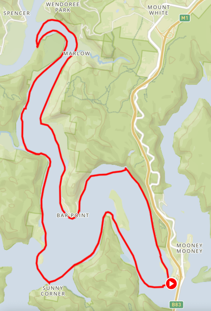
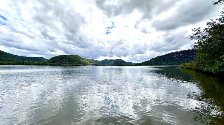
Spencer is one of my favourite local areas to paddle, nestled at the wide junction where Mangrove Creek merges with the Hawkesbury River. If launching from Spencer, you have several paddling options: following the Hawkesbury River downstream towards Mooney Mooney and beyond that the sea or off to Berowra Creek, upstream towards the awesome Wiseman’s Ferry, or up Mangrove Creek where you can progress about 15km (if you don’t mind lugging your kayak over a substantial weir).
However, although it’s only 50km away, the 45 mins to an hour’s drive on a sometimes winding and potholed country road to get there somehow always feels a lot longer – so we don’t often go. Today though, we chose to paddle upstream from Mooney Mooney (Deerubbun Reserve boat ramp) to Spencer – a pothole-free run!
Trip plan details
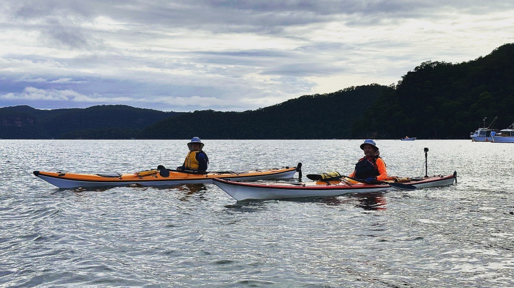
- Group size – 3
- Distance – 31 km (actual 32.6km)
- Duration – 8 hrs (actual 7hr 30min)
- Weather – cloud/showers, 23°C, moderate breeze (12 kts)
As usual, today’s route was selected to capitalise on favourable tides, on this occasion rising from about 7.30am and achieving fullness at Spencer by about 1pm, with the plan being to arrive at Spencer late morning, cook-up some lunch and then be ready to return on the ebb flow. And avoid any strengthening moderate easterly breezes that would be blowing in our faces on the way home!
The usual MO is to rendezvous at the Coles servo at Kariong at about 6.30am, then travel in convoy (keeping an eye on each others’ kayaks) down to Mooney Mooney (Deerubbun Reserve boat ramp) just off the M1 Pacific Motorway. 25 mins later we were unloading our kayaks and gear onto the small strip of sand adjacent to, and on the western side of, the double boat ramp, and then moving the cars to near-by parking spaces. (It pays to arrive early at this spot, as although there’s a fair amount of parking capacity, the proximity of the site to the motorway – and to Sydney – means it’s popular with water sport lovers and campers year-round.)

With Autumn now upon us – the cloud, light rain and cooler temperature being a reminder – we brought with us waterproofs and spare warm clothes, kept in separate dry-bags stowed away for ‘just in case’. (Even if you stay dry, stopping for lunch and being less active after the exertions of the paddle can see body temperatures drop somewhat and I often opt for sporting a natty beanie when stopped.) This clothing was in addition to the usual safety gear of spare paddle (yes – I have been out, far from ‘home’ and broken a paddle blade!), tow systems, hand pumps, first aid kit, multi-tool, duct tape, torch – and personal locator beacon (PLB), with the trip plan also registered with AMSA (the Australian Maritime Safety Authority).
Our preferred route for this section of water is to cut straight across the Hawkesbury to the opposite shoreline from the launch point, being mindful of the prevailing current and tidal flow. We then track upstream following the channel navigation markers to avoid the obstacle-laden shallows, and through Milson’s Passage, where the position of the island in the bend of the river means the water travelling through this narrow channel on the western side of Milson Island often has a mind of its own.
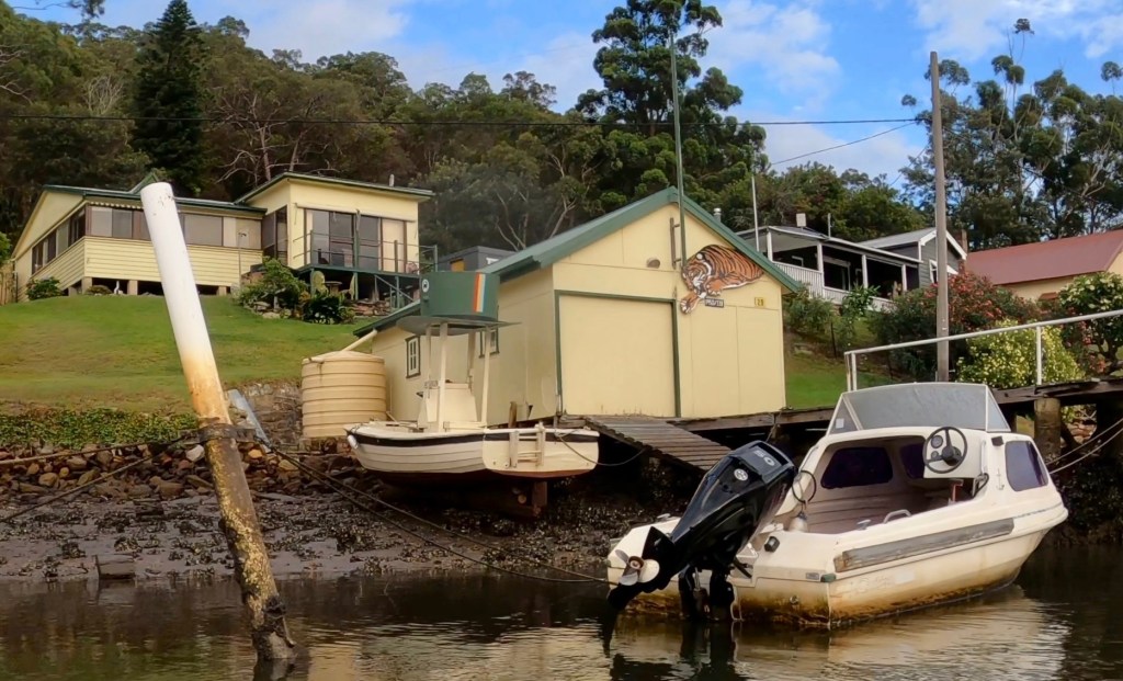
The ‘Republic of Milson’s Passage’ comprises about 40 dwellings, all reached just by water. ‘The Top Hat’ boat is a familiar sight, as is the community’s flag, flying from flagpoles on many of the properties, and boasting a mud crab on a green background and stripes of light blue, yellow and red, which are the official colours of Milson’s Passage Rural Fire Service ( RFS).
Rounding Prickly Point at the apex of the bend in the Hawkesbury, we then headed south along the shoreline to Muogamarra Point, from where we cut across Berowra Waters (and what would become Berowra Creek), over to Fisherman’s Point which houses the rather fancy Marramarra Lodge Resort, adjacent to Bar Island, to then continue up the Hawkesbury.
Whilst not so great for our photos, the overcast skies provided some shelter from the normally fierce sun and UV that are typically experienced out on this water, and for today at least, we weren’t complaining.
Cruising upstream past the many mangroves along the river’s shore for that section, we benefitted from travelling on the slack and ebb tides and made great time to our lunchtime destination, the Gentleman’s Halt camp site, nestled in a small ‘headland’ created by a large bend in the Hawkesbury River, and situated directly across the river from Spencer, at the junction of the Hawkesbury and Mangrove Creek.
We’d made such good time, in fact, we were now at risk of having a rising tide (still) in our faces for some of the return journey, so we considered a Plan B route. This would be an additional 4-5km run up Mangrove Creek, and a quick nip into Popran Creek where I knew there to be some good spots to pull-up for lunch. That would likely add an overall 10km and hour-and-a-half to the route and not all of the group had covered the distance that would result for the day’s overall outing. “Stick to the plan,” the little voice in my head said, “stick to the plan.” – and that’s what we did.
Typically lunch is last night’s leftovers, but as the seasons move forward and the cooler weather approaches hot food freshly cooked-up on a stove is just the best way to address any encroaching fatigue – and for this purpose I pack a couple of JetBoil stoves. Today’s menu comprised bacon and eggs, wraps, salad, nuts and chocolate, washed down with freshly-brewed tea and coffee – with everyone contributing to the food supplies.
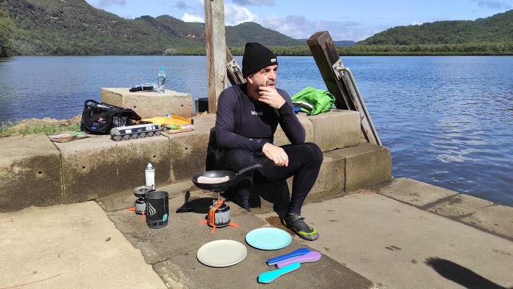
And on previous visits to this location we’d always traipsed up the short incline to the campsite proper, but today, the sandstone wharf just cried-out to be used as our lunch spot, affording an amazing, expansive view of the river laid out before us, with Spencer in the distance. A perfect spot to take lunch, we spent well over a hour here, taking in the scenery, enjoying some great conversation, and watching the tide slowly rise up almost to its high mark.
After finishing up lunch, stowing our gear and conducting some last minute checks on hatches, paddle leashes, sunscreen etc. we dropped our boats back into the water and headed off to the Spencer side of the river to make a completely different track back home. And we timed things just right so that we started to catch the falling tide for our return run, and for much of the way we scored a decent 3-4kt cruising speed without too much effort – perfect!
I much prefer ‘one-way’ paddles, but as these generally require some form of complex shuttle-run between start/finish points using a couple of cars – and are tricky to sort for three paddlers – the alternative is to try and create a circuitous paddle route, or at the very least a route following different shorelines.
Taking the opposite shoreline route home is also a great way to be able to fully appreciate the efforts of your outbound paddle, and I love to survey everything lying ahead of me with the knowledge that I have – or will soon have – placed my kayak pretty much everywhere I can see!
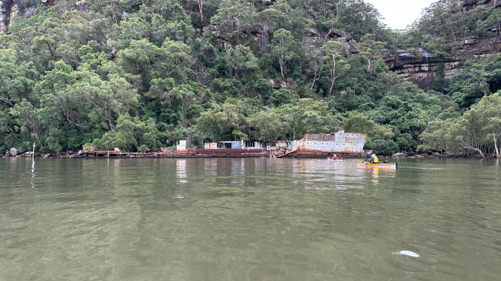
Although there’s not too much to see these days, especially at higher tides, stopping-in to check out the rusting remains of the hull of HMAS Parramatta, Australia’s First Warship, a River-Class Torpedo-Boat Destroyer of the Royal Australian Navy (RAN; and dating from 1910), is surely an obligation of any kayaker. Sat against a beautiful backdrop of gum tree-covered sandstone cliffs, with a waterfall adding to the maritime soundtrack, it really is worth paying this piece of history some time and respect every time you paddle by.
The final leg, from HMAS Parramatta back to the launch point, was a straight-forward 5km, ably assisted by a friendly tide and current, and with none of the moderate breeze that had been forecast. Before departure, checking the previous few days’ weather ‘actuals’ had shown that wind forecasts had consistently not been realised. We’d have absolutely been fine to paddle if the forecast winds had materialised, but it was so nice to not have that final bit of resistance on the last leg.
Safely returned to the launch point, we took-out our kayaks at about 3pm, 30mins ahead of schedule, a result that I was super-pleased with We’d met up at our morning rendezvous point on time, arrived at Deerubbun on time, launched bang-on the planned departure time of 7.30am, covered the planned distance, had a great lunch, missed the rain (a bit of drizzle doesn’t count!), dodged the wind and got back on time! And that extra 30mins gave us the chance to crank-up the Jetboil for one final brew before heading-off home.
“Stick to the plan”..!

What a great trip and so well described.
LikeLiked by 1 person
Great description of this journey. I’m planning a trip from Berowra Waters with an overnight at Twin Beaches and trip to Gentleman’s halt the following day and back to Mooney Mooney bridge. Do you have any suggestions of nice places to get out for lunch or a swim along this route?
LikeLiked by 1 person
Hi, thanks for commenting! Twin Beaches is the best swim spot, although at very low tide the sand there gives way to mud. Further up the Hawkesbury you become limited as the shores are mostly mangrove – with plenty of brown blubber jellyfish (which do sting) swimming around. Gentleman’s Halt is also a great campground but again, swimming is off a muddy shoreline.
LikeLike